You are here: Home > Network List > TA - USArray Transportable Network (new EarthScope stations) Stations List
> Station K15A Arbon, ID, USA > Earthquake Result Viewer
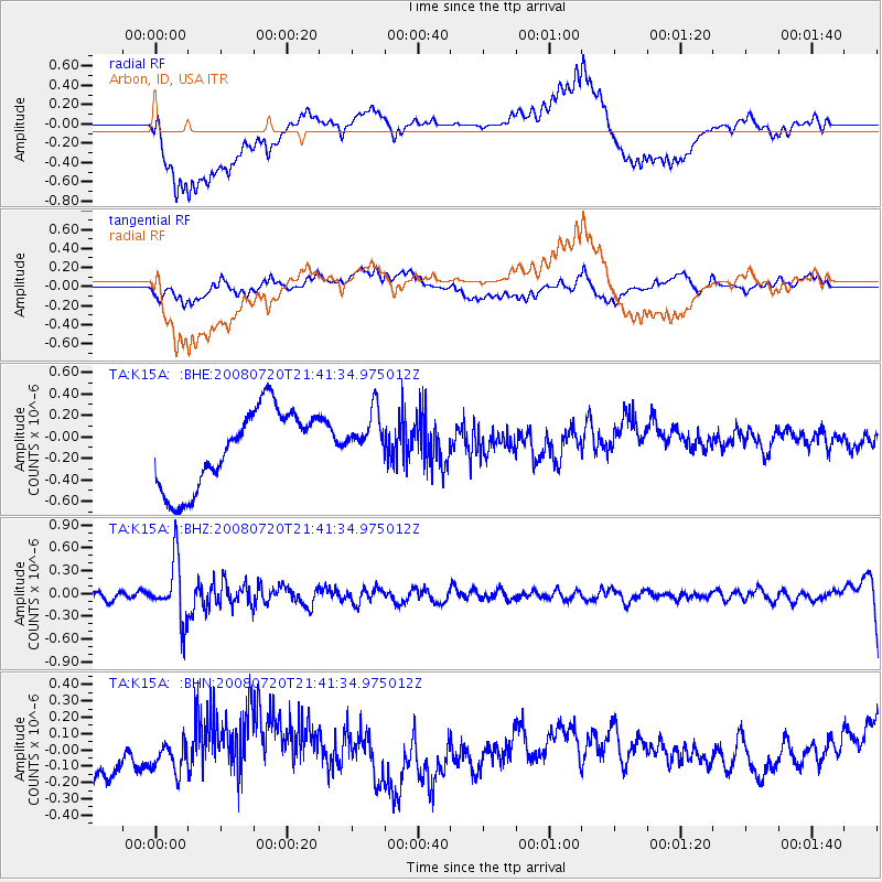
K15A Arbon, ID, USA - Earthquake Result Viewer
*The percent match for this event was below the threshold and hence no stack was calculated.
| Earthquake location: |
Bonin Islands, Japan Region |
| Earthquake latitude/longitude: |
27.8/139.6 |
| Earthquake time(UTC): |
2008/07/20 (202) 21:30:29 GMT |
| Earthquake Depth: |
481 km |
| Earthquake Magnitude: |
5.8 MW, 5.1 MB, 5.8 MW |
| Earthquake Catalog/Contributor: |
WHDF/NEIC |
|
| Network: |
TA USArray Transportable Network (new EarthScope stations) |
| Station: |
K15A Arbon, ID, USA |
| Lat/Lon: |
42.69 N/112.53 W |
| Elevation: |
1566 m |
|
| Distance: |
83.5 deg |
| Az: |
44.939 deg |
| Baz: |
301.916 deg |
| Ray Param: |
$rayparam |
*The percent match for this event was below the threshold and hence was not used in the summary stack. |
|
| Radial Match: |
52.62548 % |
| Radial Bump: |
400 |
| Transverse Match: |
56.774128 % |
| Transverse Bump: |
400 |
| SOD ConfigId: |
2504 |
| Insert Time: |
2010-03-06 08:49:56.200 +0000 |
| GWidth: |
2.5 |
| Max Bumps: |
400 |
| Tol: |
0.001 |
|
Signal To Noise
| Channel | StoN | STA | LTA |
| TA:K15A: :BHZ:20080720T21:41:34.975012Z | 4.7042427 | 3.9339656E-7 | 8.362591E-8 |
| TA:K15A: :BHN:20080720T21:41:34.975012Z | 0.35253257 | 1.1197156E-7 | 3.1762045E-7 |
| TA:K15A: :BHE:20080720T21:41:34.975012Z | 0.65032566 | 2.3658257E-7 | 3.6379092E-7 |
| Arrivals |
| Ps | |
| PpPs | |
| PsPs/PpSs | |


