You are here: Home > Network List > TA - USArray Transportable Network (new EarthScope stations) Stations List
> Station K15A Arbon, ID, USA > Earthquake Result Viewer
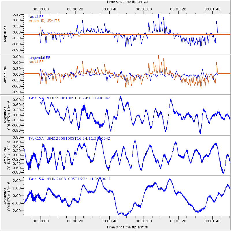
K15A Arbon, ID, USA - Earthquake Result Viewer
*The percent match for this event was below the threshold and hence no stack was calculated.
| Earthquake location: |
Tajikistan-Xinjiang Border Reg. |
| Earthquake latitude/longitude: |
39.5/73.9 |
| Earthquake time(UTC): |
2008/10/05 (279) 16:11:10 GMT |
| Earthquake Depth: |
35 km |
| Earthquake Magnitude: |
5.6 MB |
| Earthquake Catalog/Contributor: |
WHDF/NEIC |
|
| Network: |
TA USArray Transportable Network (new EarthScope stations) |
| Station: |
K15A Arbon, ID, USA |
| Lat/Lon: |
42.69 N/112.53 W |
| Elevation: |
1566 m |
|
| Distance: |
98.0 deg |
| Az: |
4.775 deg |
| Baz: |
354.99 deg |
| Ray Param: |
$rayparam |
*The percent match for this event was below the threshold and hence was not used in the summary stack. |
|
| Radial Match: |
60.038216 % |
| Radial Bump: |
400 |
| Transverse Match: |
50.61389 % |
| Transverse Bump: |
318 |
| SOD ConfigId: |
2560 |
| Insert Time: |
2010-03-06 08:50:14.509 +0000 |
| GWidth: |
2.5 |
| Max Bumps: |
400 |
| Tol: |
0.001 |
|
Signal To Noise
| Channel | StoN | STA | LTA |
| TA:K15A: :BHZ:20081005T16:24:11.399004Z | 0.7022766 | 3.0975102E-7 | 4.41067E-7 |
| TA:K15A: :BHN:20081005T16:24:11.399004Z | 1.0278659 | 5.663985E-7 | 5.5104323E-7 |
| TA:K15A: :BHE:20081005T16:24:11.399004Z | 1.3050619 | 5.137308E-7 | 3.936448E-7 |
| Arrivals |
| Ps | |
| PpPs | |
| PsPs/PpSs | |


