You are here: Home > Network List > TA - USArray Transportable Network (new EarthScope stations) Stations List
> Station C16K Lisburne Hills, AK, USA > Earthquake Result Viewer
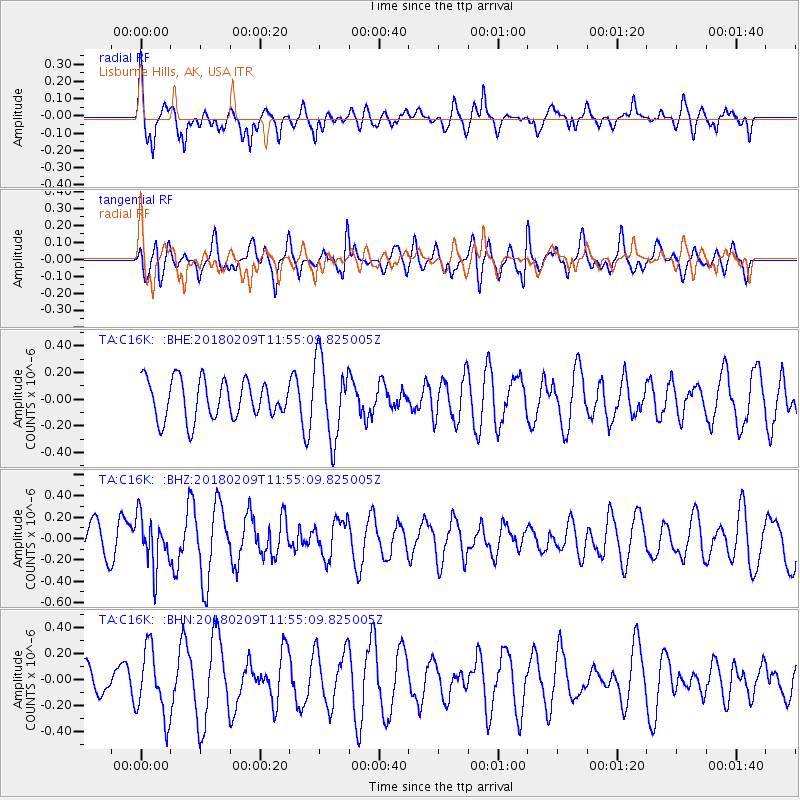
C16K Lisburne Hills, AK, USA - Earthquake Result Viewer
*The percent match for this event was below the threshold and hence no stack was calculated.
| Earthquake location: |
Fiji Islands Region |
| Earthquake latitude/longitude: |
-17.9/-178.7 |
| Earthquake time(UTC): |
2018/02/09 (040) 11:43:56 GMT |
| Earthquake Depth: |
545 km |
| Earthquake Magnitude: |
5.9 Mww |
| Earthquake Catalog/Contributor: |
NEIC PDE/us |
|
| Network: |
TA USArray Transportable Network (new EarthScope stations) |
| Station: |
C16K Lisburne Hills, AK, USA |
| Lat/Lon: |
68.27 N/165.34 W |
| Elevation: |
102 m |
|
| Distance: |
86.5 deg |
| Az: |
4.93 deg |
| Baz: |
192.698 deg |
| Ray Param: |
$rayparam |
*The percent match for this event was below the threshold and hence was not used in the summary stack. |
|
| Radial Match: |
64.63182 % |
| Radial Bump: |
358 |
| Transverse Match: |
46.621452 % |
| Transverse Bump: |
374 |
| SOD ConfigId: |
13570011 |
| Insert Time: |
2019-04-29 18:39:43.490 +0000 |
| GWidth: |
2.5 |
| Max Bumps: |
400 |
| Tol: |
0.001 |
|
Signal To Noise
| Channel | StoN | STA | LTA |
| TA:C16K: :BHZ:20180209T11:55:09.825005Z | 1.3788278 | 2.354982E-7 | 1.7079596E-7 |
| TA:C16K: :BHN:20180209T11:55:09.825005Z | 2.51541 | 2.6232394E-7 | 1.0428675E-7 |
| TA:C16K: :BHE:20180209T11:55:09.825005Z | 2.027445 | 2.9431914E-7 | 1.4516749E-7 |
| Arrivals |
| Ps | |
| PpPs | |
| PsPs/PpSs | |


