You are here: Home > Network List > TA - USArray Transportable Network (new EarthScope stations) Stations List
> Station G22K Bettles, AK, USA > Earthquake Result Viewer
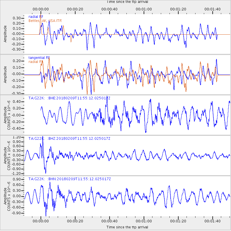
G22K Bettles, AK, USA - Earthquake Result Viewer
*The percent match for this event was below the threshold and hence no stack was calculated.
| Earthquake location: |
Fiji Islands Region |
| Earthquake latitude/longitude: |
-17.9/-178.7 |
| Earthquake time(UTC): |
2018/02/09 (040) 11:43:56 GMT |
| Earthquake Depth: |
545 km |
| Earthquake Magnitude: |
5.9 Mww |
| Earthquake Catalog/Contributor: |
NEIC PDE/us |
|
| Network: |
TA USArray Transportable Network (new EarthScope stations) |
| Station: |
G22K Bettles, AK, USA |
| Lat/Lon: |
66.92 N/151.51 W |
| Elevation: |
205 m |
|
| Distance: |
86.9 deg |
| Az: |
10.381 deg |
| Baz: |
205.802 deg |
| Ray Param: |
$rayparam |
*The percent match for this event was below the threshold and hence was not used in the summary stack. |
|
| Radial Match: |
51.98633 % |
| Radial Bump: |
400 |
| Transverse Match: |
70.923294 % |
| Transverse Bump: |
400 |
| SOD ConfigId: |
13570011 |
| Insert Time: |
2019-04-29 18:40:16.314 +0000 |
| GWidth: |
2.5 |
| Max Bumps: |
400 |
| Tol: |
0.001 |
|
Signal To Noise
| Channel | StoN | STA | LTA |
| TA:G22K: :BHZ:20180209T11:55:12.025017Z | 2.1939914 | 5.8535437E-7 | 2.6679885E-7 |
| TA:G22K: :BHN:20180209T11:55:12.025017Z | 1.7823521 | 4.567927E-7 | 2.5628646E-7 |
| TA:G22K: :BHE:20180209T11:55:12.025017Z | 0.56338686 | 9.9904554E-8 | 1.773285E-7 |
| Arrivals |
| Ps | |
| PpPs | |
| PsPs/PpSs | |


