X14A Yava, AZ, USA - Earthquake Result Viewer
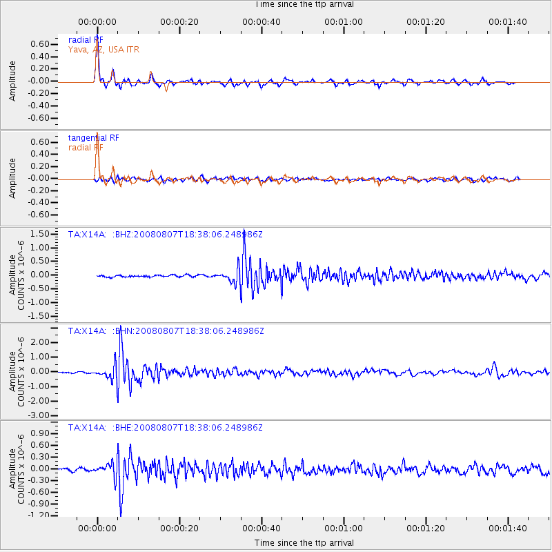
Earthquake location: Andreanof Islands, Aleutian Is.
Earthquake latitude/longitude: 52.2/-175.7
Earthquake time(UTC): 2008/08/07 (220) 18:30:03 GMT
Earthquake Depth: 12 km
Earthquake Magnitude: 5.6 MB, 5.5 MS, 5.8 MW, 5.8 MW
Earthquake Catalog/Contributor: WHDF/NEIC
Network: TA USArray Transportable Network (new EarthScope stations)
Station: X14A Yava, AZ, USA
Lat/Lon: 34.47 N/112.89 W
Elevation: 1078 m
Distance: 47.4 deg
Az: 86.198 deg
Baz: 311.972 deg
Ray Param: 0.07000435
Estimated Moho Depth: 63.75 km
Estimated Crust Vp/Vs: 1.60
Assumed Crust Vp: 6.276 km/s
Estimated Crust Vs: 3.922 km/s
Estimated Crust Poisson's Ratio: 0.18
Radial Match: 90.19179 %
Radial Bump: 350
Transverse Match: 72.309845 %
Transverse Bump: 400
SOD ConfigId: 2504
Insert Time: 2010-03-06 08:50:46.215 +0000
GWidth: 2.5
Max Bumps: 400
Tol: 0.001

Signal To Noise

ChannelStoNSTALTA
TA:X14A: :BHN:20080807T18:38:06.248986Z13.2214934.873609E-73.6861262E-8
TA:X14A: :BHE:20080807T18:38:06.248986Z4.292921.6772772E-73.907078E-8
TA:X14A: :BHZ:20080807T18:38:06.248986Z7.45524742.383693E-73.197336E-8
Arrivals
Ps6.5 SECOND
PpPs25 SECOND
PsPs/PpSs31 SECOND