You are here: Home > Network List > TA - USArray Transportable Network (new EarthScope stations) Stations List
> Station J26L Joseph Creek, AK, USA > Earthquake Result Viewer
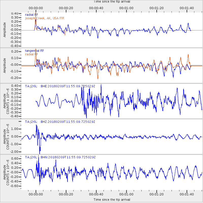
J26L Joseph Creek, AK, USA - Earthquake Result Viewer
*The percent match for this event was below the threshold and hence no stack was calculated.
| Earthquake location: |
Fiji Islands Region |
| Earthquake latitude/longitude: |
-17.9/-178.7 |
| Earthquake time(UTC): |
2018/02/09 (040) 11:43:56 GMT |
| Earthquake Depth: |
545 km |
| Earthquake Magnitude: |
5.9 Mww |
| Earthquake Catalog/Contributor: |
NEIC PDE/us |
|
| Network: |
TA USArray Transportable Network (new EarthScope stations) |
| Station: |
J26L Joseph Creek, AK, USA |
| Lat/Lon: |
64.50 N/143.56 W |
| Elevation: |
1144 m |
|
| Distance: |
86.4 deg |
| Az: |
14.441 deg |
| Baz: |
213.272 deg |
| Ray Param: |
$rayparam |
*The percent match for this event was below the threshold and hence was not used in the summary stack. |
|
| Radial Match: |
49.104877 % |
| Radial Bump: |
325 |
| Transverse Match: |
57.24627 % |
| Transverse Bump: |
390 |
| SOD ConfigId: |
13570011 |
| Insert Time: |
2019-04-29 18:40:35.759 +0000 |
| GWidth: |
2.5 |
| Max Bumps: |
400 |
| Tol: |
0.001 |
|
Signal To Noise
| Channel | StoN | STA | LTA |
| TA:J26L: :BHZ:20180209T11:55:09.725029Z | 5.3683114 | 8.5634355E-7 | 1.5951824E-7 |
| TA:J26L: :BHN:20180209T11:55:09.725029Z | 1.9482504 | 2.5744825E-7 | 1.3214331E-7 |
| TA:J26L: :BHE:20180209T11:55:09.725029Z | 2.4148657 | 2.0147924E-7 | 8.3432894E-8 |
| Arrivals |
| Ps | |
| PpPs | |
| PsPs/PpSs | |


