You are here: Home > Network List > TA - USArray Transportable Network (new EarthScope stations) Stations List
> Station N23A Red Feather Lakes, CO, USA > Earthquake Result Viewer
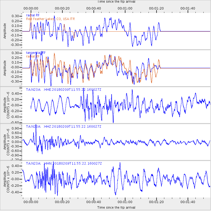
N23A Red Feather Lakes, CO, USA - Earthquake Result Viewer
*The percent match for this event was below the threshold and hence no stack was calculated.
| Earthquake location: |
Fiji Islands Region |
| Earthquake latitude/longitude: |
-17.9/-178.7 |
| Earthquake time(UTC): |
2018/02/09 (040) 11:43:56 GMT |
| Earthquake Depth: |
545 km |
| Earthquake Magnitude: |
5.9 Mww |
| Earthquake Catalog/Contributor: |
NEIC PDE/us |
|
| Network: |
TA USArray Transportable Network (new EarthScope stations) |
| Station: |
N23A Red Feather Lakes, CO, USA |
| Lat/Lon: |
40.89 N/105.94 W |
| Elevation: |
2458 m |
|
| Distance: |
89.1 deg |
| Az: |
46.382 deg |
| Baz: |
245.421 deg |
| Ray Param: |
$rayparam |
*The percent match for this event was below the threshold and hence was not used in the summary stack. |
|
| Radial Match: |
50.932518 % |
| Radial Bump: |
400 |
| Transverse Match: |
49.507515 % |
| Transverse Bump: |
400 |
| SOD ConfigId: |
13570011 |
| Insert Time: |
2019-04-29 18:41:06.545 +0000 |
| GWidth: |
2.5 |
| Max Bumps: |
400 |
| Tol: |
0.001 |
|
Signal To Noise
| Channel | StoN | STA | LTA |
| TA:N23A: :HHZ:20180209T11:55:22.160027Z | 3.6594663 | 3.5818684E-7 | 9.787953E-8 |
| TA:N23A: :HHN:20180209T11:55:22.160027Z | 0.7861099 | 1.4881282E-7 | 1.8930281E-7 |
| TA:N23A: :HHE:20180209T11:55:22.160027Z | 1.1898181 | 2.1486547E-7 | 1.805868E-7 |
| Arrivals |
| Ps | |
| PpPs | |
| PsPs/PpSs | |


