You are here: Home > Network List > TA - USArray Transportable Network (new EarthScope stations) Stations List
> Station R33M Jennings River, BC, CAN > Earthquake Result Viewer
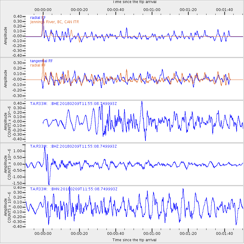
R33M Jennings River, BC, CAN - Earthquake Result Viewer
*The percent match for this event was below the threshold and hence no stack was calculated.
| Earthquake location: |
Fiji Islands Region |
| Earthquake latitude/longitude: |
-17.9/-178.7 |
| Earthquake time(UTC): |
2018/02/09 (040) 11:43:56 GMT |
| Earthquake Depth: |
545 km |
| Earthquake Magnitude: |
5.9 Mww |
| Earthquake Catalog/Contributor: |
NEIC PDE/us |
|
| Network: |
TA USArray Transportable Network (new EarthScope stations) |
| Station: |
R33M Jennings River, BC, CAN |
| Lat/Lon: |
59.39 N/130.97 W |
| Elevation: |
1437 m |
|
| Distance: |
86.2 deg |
| Az: |
22.286 deg |
| Baz: |
224.895 deg |
| Ray Param: |
$rayparam |
*The percent match for this event was below the threshold and hence was not used in the summary stack. |
|
| Radial Match: |
75.2923 % |
| Radial Bump: |
400 |
| Transverse Match: |
63.70912 % |
| Transverse Bump: |
400 |
| SOD ConfigId: |
13570011 |
| Insert Time: |
2019-04-29 18:41:27.638 +0000 |
| GWidth: |
2.5 |
| Max Bumps: |
400 |
| Tol: |
0.001 |
|
Signal To Noise
| Channel | StoN | STA | LTA |
| TA:R33M: :BHZ:20180209T11:55:08.749993Z | 5.240367 | 7.5057096E-7 | 1.432287E-7 |
| TA:R33M: :BHN:20180209T11:55:08.749993Z | 1.153544 | 1.4485816E-7 | 1.2557663E-7 |
| TA:R33M: :BHE:20180209T11:55:08.749993Z | 2.5016885 | 2.390956E-7 | 9.557369E-8 |
| Arrivals |
| Ps | |
| PpPs | |
| PsPs/PpSs | |


