You are here: Home > Network List > UW - Pacific Northwest Regional Seismic Network Stations List
> Station FISH Seaside, OR, USA > Earthquake Result Viewer
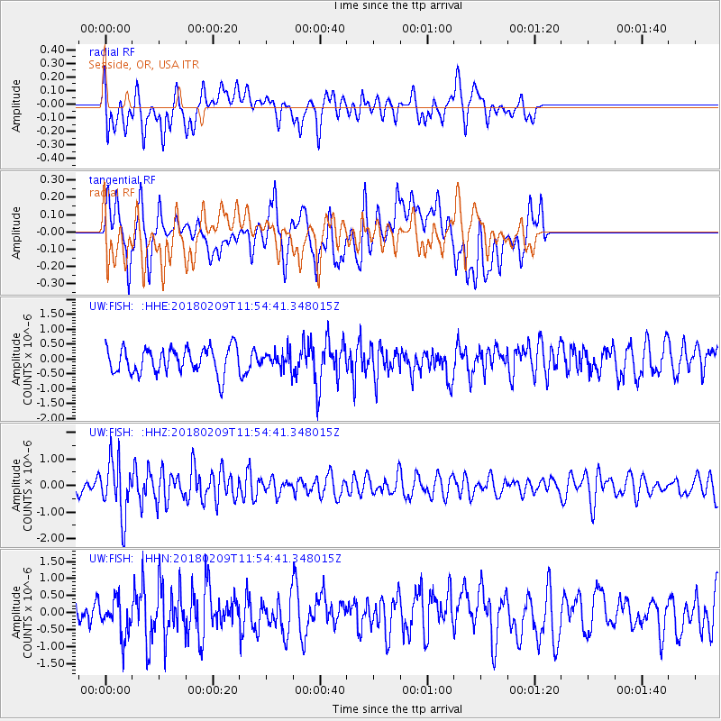
FISH Seaside, OR, USA - Earthquake Result Viewer
*The percent match for this event was below the threshold and hence no stack was calculated.
| Earthquake location: |
Fiji Islands Region |
| Earthquake latitude/longitude: |
-17.9/-178.7 |
| Earthquake time(UTC): |
2018/02/09 (040) 11:43:56 GMT |
| Earthquake Depth: |
545 km |
| Earthquake Magnitude: |
5.9 Mww |
| Earthquake Catalog/Contributor: |
NEIC PDE/us |
|
| Network: |
UW Pacific Northwest Regional Seismic Network |
| Station: |
FISH Seaside, OR, USA |
| Lat/Lon: |
45.93 N/123.56 W |
| Elevation: |
325 m |
|
| Distance: |
80.7 deg |
| Az: |
35.456 deg |
| Baz: |
232.321 deg |
| Ray Param: |
$rayparam |
*The percent match for this event was below the threshold and hence was not used in the summary stack. |
|
| Radial Match: |
48.720737 % |
| Radial Bump: |
400 |
| Transverse Match: |
54.745327 % |
| Transverse Bump: |
400 |
| SOD ConfigId: |
13570011 |
| Insert Time: |
2019-04-29 18:42:26.657 +0000 |
| GWidth: |
2.5 |
| Max Bumps: |
400 |
| Tol: |
0.001 |
|
Signal To Noise
| Channel | StoN | STA | LTA |
| UW:FISH: :HHZ:20180209T11:54:41.348015Z | 2.2930937 | 1.0401999E-6 | 4.5362296E-7 |
| UW:FISH: :HHN:20180209T11:54:41.348015Z | 1.0071431 | 5.277202E-7 | 5.2397735E-7 |
| UW:FISH: :HHE:20180209T11:54:41.348015Z | 0.62207526 | 2.6906207E-7 | 4.3252334E-7 |
| Arrivals |
| Ps | |
| PpPs | |
| PsPs/PpSs | |


