You are here: Home > Network List > G - GEOSCOPE Stations List
> Station TAOE Taiohae, Marquises islands > Earthquake Result Viewer
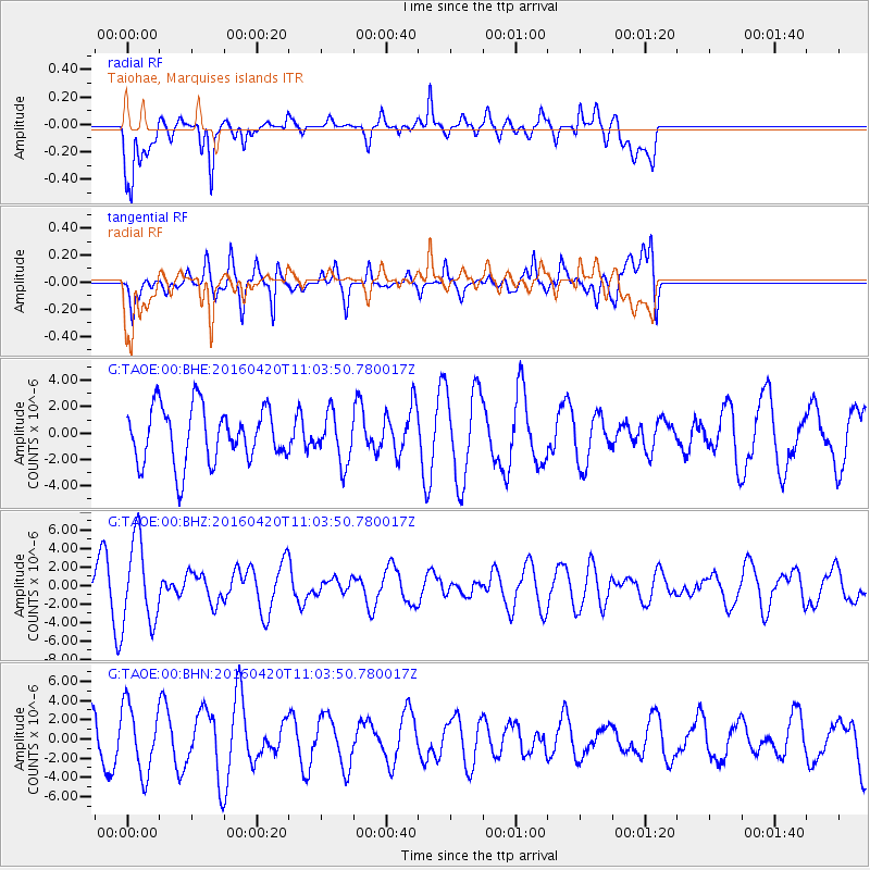
TAOE Taiohae, Marquises islands - Earthquake Result Viewer
*The percent match for this event was below the threshold and hence no stack was calculated.
| Earthquake location: |
North Atlantic Ocean |
| Earthquake latitude/longitude: |
13.2/-55.9 |
| Earthquake time(UTC): |
2016/04/20 (111) 10:51:39 GMT |
| Earthquake Depth: |
10 km |
| Earthquake Magnitude: |
5.8 MB |
| Earthquake Catalog/Contributor: |
NEIC PDE/NEIC COMCAT |
|
| Network: |
G GEOSCOPE |
| Station: |
TAOE Taiohae, Marquises islands |
| Lat/Lon: |
8.85 S/140.15 W |
| Elevation: |
800 m |
|
| Distance: |
86.4 deg |
| Az: |
260.104 deg |
| Baz: |
76.128 deg |
| Ray Param: |
$rayparam |
*The percent match for this event was below the threshold and hence was not used in the summary stack. |
|
| Radial Match: |
47.818626 % |
| Radial Bump: |
400 |
| Transverse Match: |
48.390957 % |
| Transverse Bump: |
400 |
| SOD ConfigId: |
1475611 |
| Insert Time: |
2016-05-04 10:53:54.950 +0000 |
| GWidth: |
2.5 |
| Max Bumps: |
400 |
| Tol: |
0.001 |
|
Signal To Noise
| Channel | StoN | STA | LTA |
| G:TAOE:00:BHZ:20160420T11:03:50.780017Z | 1.9103703 | 4.5776915E-6 | 2.3962325E-6 |
| G:TAOE:00:BHN:20160420T11:03:50.780017Z | 1.3693072 | 3.4890868E-6 | 2.5480672E-6 |
| G:TAOE:00:BHE:20160420T11:03:50.780017Z | 0.88620687 | 1.8563592E-6 | 2.0947246E-6 |
| Arrivals |
| Ps | |
| PpPs | |
| PsPs/PpSs | |


