You are here: Home > Network List > GS - US Geological Survey Networks Stations List
> Station DEC06 Boomer > Earthquake Result Viewer
DEC06 Boomer - Earthquake Result Viewer
*The percent match for this event was below the threshold and hence no stack was calculated.
| Earthquake location: |
North Atlantic Ocean |
| Earthquake latitude/longitude: |
13.2/-55.9 |
| Earthquake time(UTC): |
2016/04/20 (111) 10:51:39 GMT |
| Earthquake Depth: |
10 km |
| Earthquake Magnitude: |
5.8 MB |
| Earthquake Catalog/Contributor: |
NEIC PDE/NEIC COMCAT |
|
| Network: |
GS US Geological Survey Networks |
| Station: |
DEC06 Boomer |
| Lat/Lon: |
39.90 N/88.95 W |
| Elevation: |
215 m |
|
| Distance: |
39.4 deg |
| Az: |
318.616 deg |
| Baz: |
123.185 deg |
| Ray Param: |
$rayparam |
*The percent match for this event was below the threshold and hence was not used in the summary stack. |
|
| Radial Match: |
30.466967 % |
| Radial Bump: |
400 |
| Transverse Match: |
32.96556 % |
| Transverse Bump: |
400 |
| SOD ConfigId: |
1475611 |
| Insert Time: |
2016-05-04 10:54:16.344 +0000 |
| GWidth: |
2.5 |
| Max Bumps: |
400 |
| Tol: |
0.001 |
|
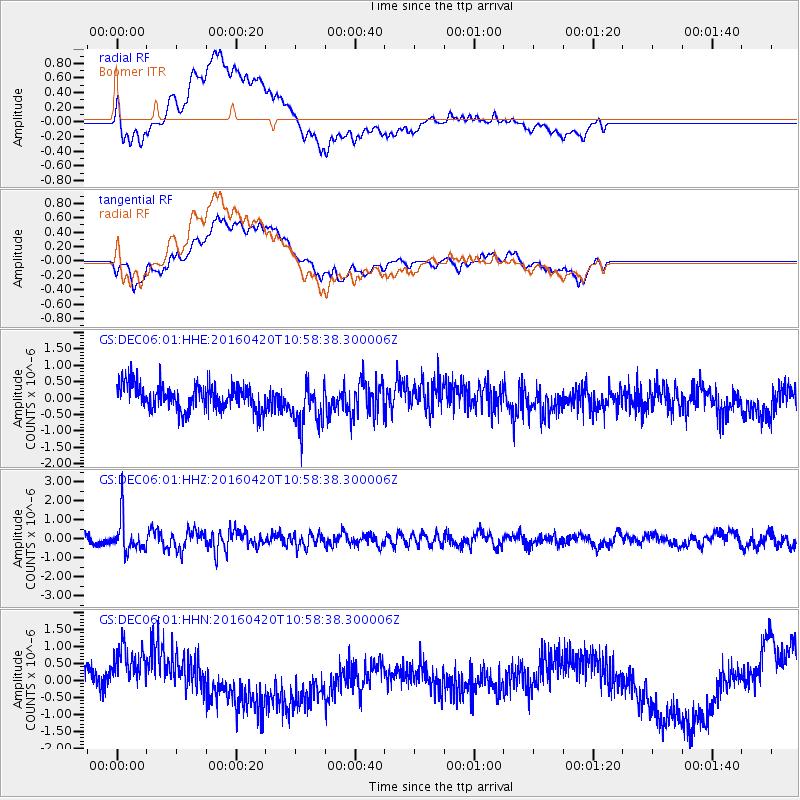
Signal To Noise
| Channel | StoN | STA | LTA |
| GS:DEC06:01:HHZ:20160420T10:58:38.300006Z | 3.5706284 | 8.9125103E-7 | 2.4960622E-7 |
| GS:DEC06:01:HHN:20160420T10:58:38.300006Z | 2.2237608 | 9.1211894E-7 | 4.1016952E-7 |
| GS:DEC06:01:HHE:20160420T10:58:38.300006Z | 1.7696037 | 6.8539623E-7 | 3.8731622E-7 |
| Arrivals |
| Ps | |
| PpPs | |
| PsPs/PpSs | |


