You are here: Home > Network List > GS - US Geological Survey Networks Stations List
> Station DEC07 Decatur Surface Seismic Site, Decatur, IL, USA > Earthquake Result Viewer
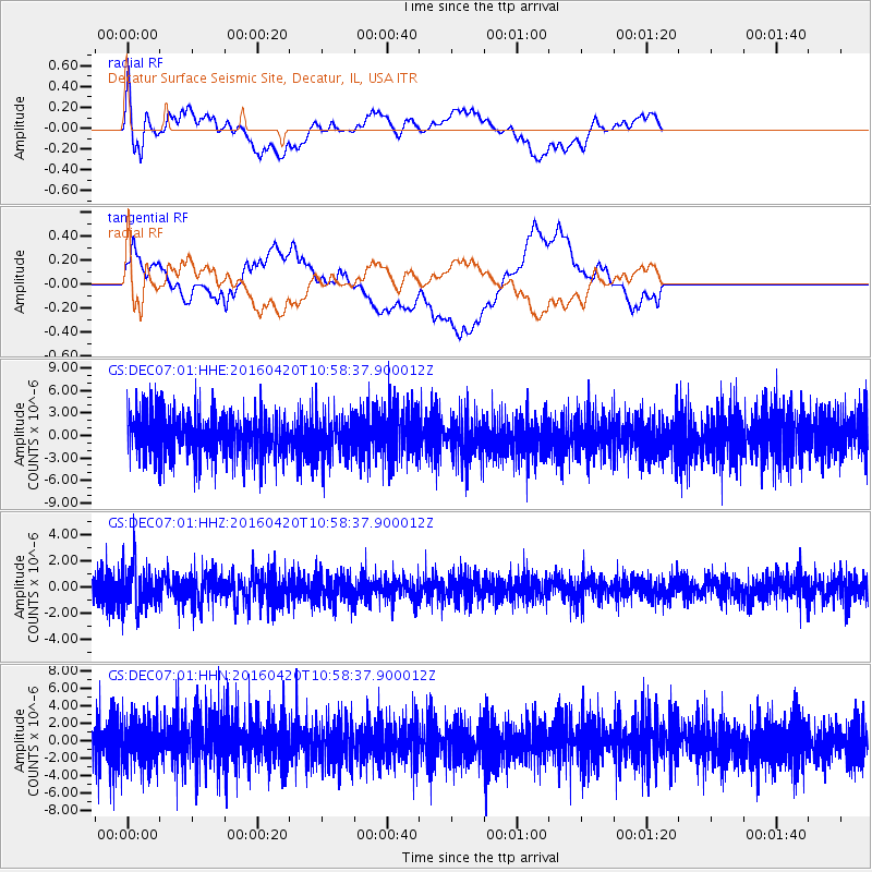
DEC07 Decatur Surface Seismic Site, Decatur, IL, USA - Earthquake Result Viewer
*The percent match for this event was below the threshold and hence no stack was calculated.
| Earthquake location: |
North Atlantic Ocean |
| Earthquake latitude/longitude: |
13.2/-55.9 |
| Earthquake time(UTC): |
2016/04/20 (111) 10:51:39 GMT |
| Earthquake Depth: |
10 km |
| Earthquake Magnitude: |
5.8 MB |
| Earthquake Catalog/Contributor: |
NEIC PDE/NEIC COMCAT |
|
| Network: |
GS US Geological Survey Networks |
| Station: |
DEC07 Decatur Surface Seismic Site, Decatur, IL, USA |
| Lat/Lon: |
39.86 N/88.90 W |
| Elevation: |
212 m |
|
| Distance: |
39.3 deg |
| Az: |
318.606 deg |
| Baz: |
123.208 deg |
| Ray Param: |
$rayparam |
*The percent match for this event was below the threshold and hence was not used in the summary stack. |
|
| Radial Match: |
54.599148 % |
| Radial Bump: |
400 |
| Transverse Match: |
30.452831 % |
| Transverse Bump: |
400 |
| SOD ConfigId: |
1475611 |
| Insert Time: |
2016-05-04 10:54:23.347 +0000 |
| GWidth: |
2.5 |
| Max Bumps: |
400 |
| Tol: |
0.001 |
|
Signal To Noise
| Channel | StoN | STA | LTA |
| GS:DEC07:01:HHZ:20160420T10:58:37.900012Z | 1.5750469 | 1.6576706E-6 | 1.052458E-6 |
| GS:DEC07:01:HHN:20160420T10:58:37.900012Z | 1.0708156 | 2.5737709E-6 | 2.4035614E-6 |
| GS:DEC07:01:HHE:20160420T10:58:37.900012Z | 0.9442325 | 2.7128435E-6 | 2.8730672E-6 |
| Arrivals |
| Ps | |
| PpPs | |
| PsPs/PpSs | |


