X14A Yava, AZ, USA - Earthquake Result Viewer
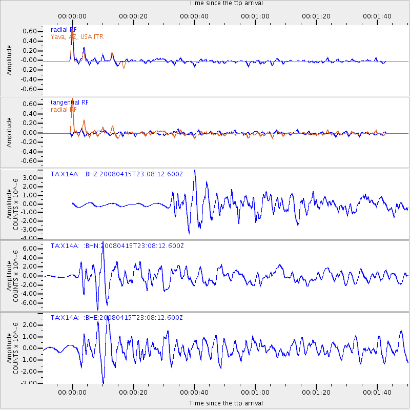
Earthquake location: Andreanof Islands, Aleutian Is.
Earthquake latitude/longitude: 51.9/-179.4
Earthquake time(UTC): 2008/04/15 (106) 22:59:51 GMT
Earthquake Depth: 10 km
Earthquake Magnitude: 6.1 MB, 6.4 MS, 6.4 MW, 6.4 MW
Earthquake Catalog/Contributor: WHDF/NEIC
Network: TA USArray Transportable Network (new EarthScope stations)
Station: X14A Yava, AZ, USA
Lat/Lon: 34.47 N/112.89 W
Elevation: 1078 m
Distance: 49.7 deg
Az: 83.175 deg
Baz: 311.808 deg
Ray Param: 0.06852121
Estimated Moho Depth: 32.25 km
Estimated Crust Vp/Vs: 1.71
Assumed Crust Vp: 6.276 km/s
Estimated Crust Vs: 3.665 km/s
Estimated Crust Poisson's Ratio: 0.24
Radial Match: 93.73785 %
Radial Bump: 301
Transverse Match: 82.55563 %
Transverse Bump: 400
SOD ConfigId: 2504
Insert Time: 2010-03-06 08:54:09.795 +0000
GWidth: 2.5
Max Bumps: 400
Tol: 0.001

Signal To Noise

ChannelStoNSTALTA
TA:X14A: :BHN:20080415T23:08:12.600Z6.4505361.4950974E-62.317788E-7
TA:X14A: :BHE:20080415T23:08:12.600Z3.83542286.1412123E-71.6011826E-7
TA:X14A: :BHZ:20080415T23:08:12.600Z4.2505166.512082E-71.5320686E-7
Arrivals
Ps3.9 SECOND
PpPs13 SECOND
PsPs/PpSs17 SECOND