X14A Yava, AZ, USA - Earthquake Result Viewer
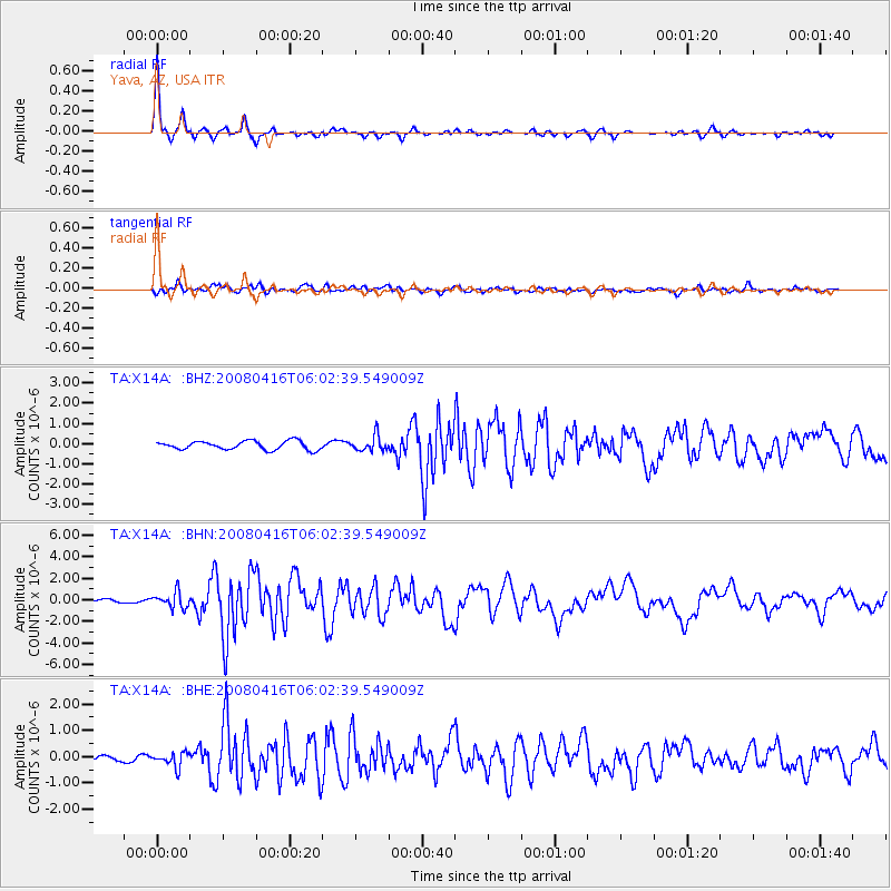
Earthquake location: Andreanof Islands, Aleutian Is.
Earthquake latitude/longitude: 51.9/-179.2
Earthquake time(UTC): 2008/04/16 (107) 05:54:19 GMT
Earthquake Depth: 13 km
Earthquake Magnitude: 6.1 MB, 6.5 MS, 6.6 MW, 6.6 MW
Earthquake Catalog/Contributor: WHDF/NEIC
Network: TA USArray Transportable Network (new EarthScope stations)
Station: X14A Yava, AZ, USA
Lat/Lon: 34.47 N/112.89 W
Elevation: 1078 m
Distance: 49.6 deg
Az: 83.334 deg
Baz: 311.821 deg
Ray Param: 0.06859109
Estimated Moho Depth: 28.75 km
Estimated Crust Vp/Vs: 1.81
Assumed Crust Vp: 6.276 km/s
Estimated Crust Vs: 3.472 km/s
Estimated Crust Poisson's Ratio: 0.28
Radial Match: 96.50559 %
Radial Bump: 303
Transverse Match: 88.566475 %
Transverse Bump: 400
SOD ConfigId: 2504
Insert Time: 2010-03-06 08:54:15.282 +0000
GWidth: 2.5
Max Bumps: 400
Tol: 0.001

Signal To Noise

ChannelStoNSTALTA
TA:X14A: :BHN:20080416T06:02:39.549009Z4.8196057.20103E-71.494112E-7
TA:X14A: :BHE:20080416T06:02:39.549009Z3.50131182.7348722E-77.810993E-8
TA:X14A: :BHZ:20080416T06:02:39.549009Z1.76515333.7550018E-72.127295E-7
Arrivals
Ps3.9 SECOND
PpPs12 SECOND
PsPs/PpSs16 SECOND