You are here: Home > Network List > TA - USArray Transportable Network (new EarthScope stations) Stations List
> Station F20K Avaraart Lake, AK, USA > Earthquake Result Viewer
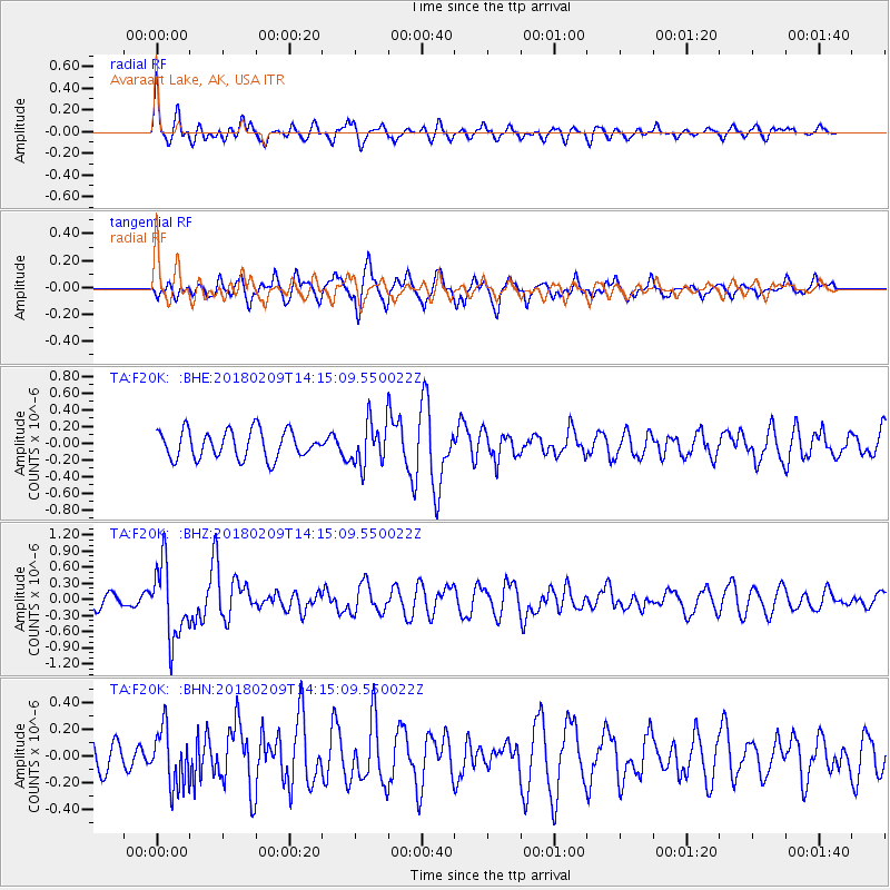
F20K Avaraart Lake, AK, USA - Earthquake Result Viewer
*The percent match for this event was below the threshold and hence no stack was calculated.
| Earthquake location: |
Near Coast Of Jalisco, Mexico |
| Earthquake latitude/longitude: |
18.9/-104.8 |
| Earthquake time(UTC): |
2018/02/09 (040) 14:05:47 GMT |
| Earthquake Depth: |
10 km |
| Earthquake Magnitude: |
5.8 Mww |
| Earthquake Catalog/Contributor: |
NEIC PDE/us |
|
| Network: |
TA USArray Transportable Network (new EarthScope stations) |
| Station: |
F20K Avaraart Lake, AK, USA |
| Lat/Lon: |
67.05 N/155.73 W |
| Elevation: |
136 m |
|
| Distance: |
58.0 deg |
| Az: |
338.953 deg |
| Baz: |
119.882 deg |
| Ray Param: |
$rayparam |
*The percent match for this event was below the threshold and hence was not used in the summary stack. |
|
| Radial Match: |
70.2482 % |
| Radial Bump: |
400 |
| Transverse Match: |
69.08659 % |
| Transverse Bump: |
400 |
| SOD ConfigId: |
13570011 |
| Insert Time: |
2019-04-29 18:49:47.801 +0000 |
| GWidth: |
2.5 |
| Max Bumps: |
400 |
| Tol: |
0.001 |
|
Signal To Noise
| Channel | StoN | STA | LTA |
| TA:F20K: :BHZ:20180209T14:15:09.550022Z | 4.6633534 | 6.8897884E-7 | 1.4774322E-7 |
| TA:F20K: :BHN:20180209T14:15:09.550022Z | 1.6260247 | 2.1337026E-7 | 1.3122202E-7 |
| TA:F20K: :BHE:20180209T14:15:09.550022Z | 1.5558311 | 2.5893385E-7 | 1.66428E-7 |
| Arrivals |
| Ps | |
| PpPs | |
| PsPs/PpSs | |


