You are here: Home > Network List > GS - US Geological Survey Networks Stations List
> Station OK043 N2390 and E0400 Rds, Waynoka, OK, USA > Earthquake Result Viewer
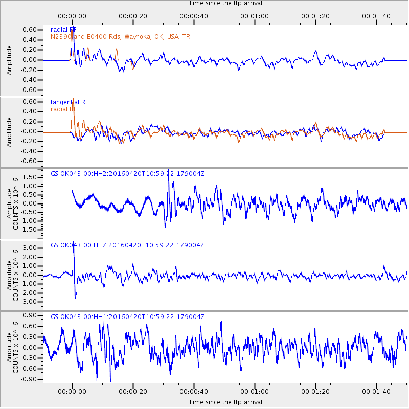
OK043 N2390 and E0400 Rds, Waynoka, OK, USA - Earthquake Result Viewer
*The percent match for this event was below the threshold and hence no stack was calculated.
| Earthquake location: |
North Atlantic Ocean |
| Earthquake latitude/longitude: |
13.2/-55.9 |
| Earthquake time(UTC): |
2016/04/20 (111) 10:51:39 GMT |
| Earthquake Depth: |
10 km |
| Earthquake Magnitude: |
5.8 MB |
| Earthquake Catalog/Contributor: |
NEIC PDE/NEIC COMCAT |
|
| Network: |
GS US Geological Survey Networks |
| Station: |
OK043 N2390 and E0400 Rds, Waynoka, OK, USA |
| Lat/Lon: |
36.43 N/98.75 W |
| Elevation: |
406 m |
|
| Distance: |
44.7 deg |
| Az: |
308.858 deg |
| Baz: |
109.881 deg |
| Ray Param: |
$rayparam |
*The percent match for this event was below the threshold and hence was not used in the summary stack. |
|
| Radial Match: |
63.908348 % |
| Radial Bump: |
400 |
| Transverse Match: |
57.56211 % |
| Transverse Bump: |
400 |
| SOD ConfigId: |
1475611 |
| Insert Time: |
2016-05-04 10:57:39.762 +0000 |
| GWidth: |
2.5 |
| Max Bumps: |
400 |
| Tol: |
0.001 |
|
Signal To Noise
| Channel | StoN | STA | LTA |
| GS:OK043:00:HHZ:20160420T10:59:22.179004Z | 7.818833 | 1.2245622E-6 | 1.5661702E-7 |
| GS:OK043:00:HH1:20160420T10:59:22.179004Z | 1.9229916 | 3.4378309E-7 | 1.7877512E-7 |
| GS:OK043:00:HH2:20160420T10:59:22.179004Z | 2.5412269 | 7.7089146E-7 | 3.0335406E-7 |
| Arrivals |
| Ps | |
| PpPs | |
| PsPs/PpSs | |


