You are here: Home > Network List > TA - USArray Transportable Network (new EarthScope stations) Stations List
> Station 121A Cookes Peak, Deming, NM, USA > Earthquake Result Viewer
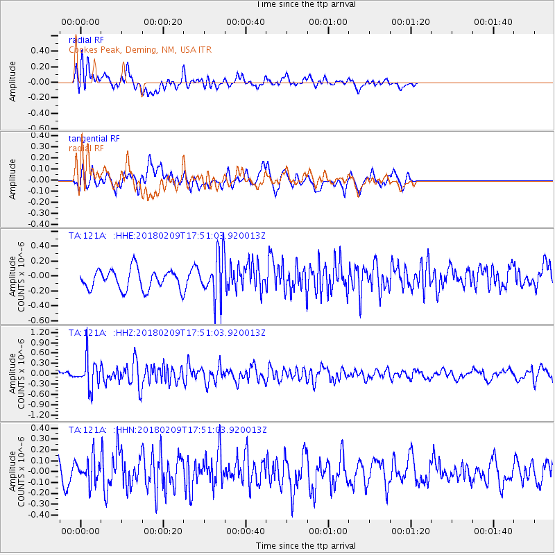
121A Cookes Peak, Deming, NM, USA - Earthquake Result Viewer
*The percent match for this event was below the threshold and hence no stack was calculated.
| Earthquake location: |
Leeward Islands |
| Earthquake latitude/longitude: |
19.0/-61.7 |
| Earthquake time(UTC): |
2018/02/09 (040) 17:43:34 GMT |
| Earthquake Depth: |
9.9 km |
| Earthquake Magnitude: |
5.5 Mi |
| Earthquake Catalog/Contributor: |
NEIC PDE/pt |
|
| Network: |
TA USArray Transportable Network (new EarthScope stations) |
| Station: |
121A Cookes Peak, Deming, NM, USA |
| Lat/Lon: |
32.53 N/107.79 W |
| Elevation: |
1652 m |
|
| Distance: |
43.3 deg |
| Az: |
297.544 deg |
| Baz: |
96.595 deg |
| Ray Param: |
$rayparam |
*The percent match for this event was below the threshold and hence was not used in the summary stack. |
|
| Radial Match: |
39.3988 % |
| Radial Bump: |
400 |
| Transverse Match: |
64.39606 % |
| Transverse Bump: |
400 |
| SOD ConfigId: |
13570011 |
| Insert Time: |
2019-04-29 18:57:24.109 +0000 |
| GWidth: |
2.5 |
| Max Bumps: |
400 |
| Tol: |
0.001 |
|
Signal To Noise
| Channel | StoN | STA | LTA |
| TA:121A: :HHZ:20180209T17:51:03.920013Z | 3.6229815 | 4.3870602E-7 | 1.2108977E-7 |
| TA:121A: :HHN:20180209T17:51:03.920013Z | 1.0520625 | 1.17279434E-7 | 1.1147573E-7 |
| TA:121A: :HHE:20180209T17:51:03.920013Z | 2.287282 | 3.1093518E-7 | 1.3594091E-7 |
| Arrivals |
| Ps | |
| PpPs | |
| PsPs/PpSs | |


