You are here: Home > Network List > TA - USArray Transportable Network (new EarthScope stations) Stations List
> Station D25K Kavik River, AK, USA > Earthquake Result Viewer
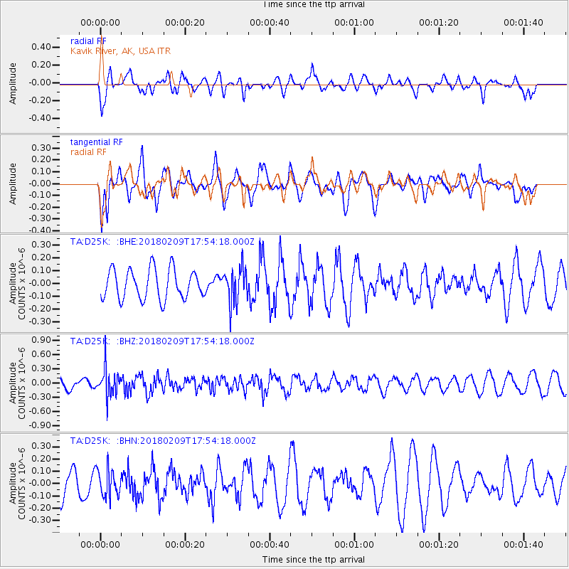
D25K Kavik River, AK, USA - Earthquake Result Viewer
*The percent match for this event was below the threshold and hence no stack was calculated.
| Earthquake location: |
Leeward Islands |
| Earthquake latitude/longitude: |
19.0/-61.7 |
| Earthquake time(UTC): |
2018/02/09 (040) 17:43:34 GMT |
| Earthquake Depth: |
9.9 km |
| Earthquake Magnitude: |
5.5 Mi |
| Earthquake Catalog/Contributor: |
NEIC PDE/pt |
|
| Network: |
TA USArray Transportable Network (new EarthScope stations) |
| Station: |
D25K Kavik River, AK, USA |
| Lat/Lon: |
69.32 N/146.38 W |
| Elevation: |
770 m |
|
| Distance: |
70.5 deg |
| Az: |
337.97 deg |
| Baz: |
88.059 deg |
| Ray Param: |
$rayparam |
*The percent match for this event was below the threshold and hence was not used in the summary stack. |
|
| Radial Match: |
53.691795 % |
| Radial Bump: |
400 |
| Transverse Match: |
69.78512 % |
| Transverse Bump: |
400 |
| SOD ConfigId: |
13570011 |
| Insert Time: |
2019-04-29 18:57:30.635 +0000 |
| GWidth: |
2.5 |
| Max Bumps: |
400 |
| Tol: |
0.001 |
|
Signal To Noise
| Channel | StoN | STA | LTA |
| TA:D25K: :BHZ:20180209T17:54:18.000Z | 2.7312655 | 2.9571106E-7 | 1.0826888E-7 |
| TA:D25K: :BHN:20180209T17:54:18.000Z | 0.877762 | 1.0688906E-7 | 1.2177455E-7 |
| TA:D25K: :BHE:20180209T17:54:18.000Z | 1.1581674 | 1.3475494E-7 | 1.1635188E-7 |
| Arrivals |
| Ps | |
| PpPs | |
| PsPs/PpSs | |


