You are here: Home > Network List > TA - USArray Transportable Network (new EarthScope stations) Stations List
> Station M31M Drury Creek, Yukon, CA > Earthquake Result Viewer
M31M Drury Creek, Yukon, CA - Earthquake Result Viewer
*The percent match for this event was below the threshold and hence no stack was calculated.
| Earthquake location: |
Leeward Islands |
| Earthquake latitude/longitude: |
19.0/-61.7 |
| Earthquake time(UTC): |
2018/02/09 (040) 17:43:34 GMT |
| Earthquake Depth: |
9.9 km |
| Earthquake Magnitude: |
5.5 Mi |
| Earthquake Catalog/Contributor: |
NEIC PDE/pt |
|
| Network: |
TA USArray Transportable Network (new EarthScope stations) |
| Station: |
M31M Drury Creek, Yukon, CA |
| Lat/Lon: |
62.20 N/134.39 W |
| Elevation: |
639 m |
|
| Distance: |
65.3 deg |
| Az: |
330.497 deg |
| Baz: |
96.187 deg |
| Ray Param: |
$rayparam |
*The percent match for this event was below the threshold and hence was not used in the summary stack. |
|
| Radial Match: |
64.85217 % |
| Radial Bump: |
400 |
| Transverse Match: |
67.76171 % |
| Transverse Bump: |
400 |
| SOD ConfigId: |
13570011 |
| Insert Time: |
2019-04-29 18:57:51.473 +0000 |
| GWidth: |
2.5 |
| Max Bumps: |
400 |
| Tol: |
0.001 |
|
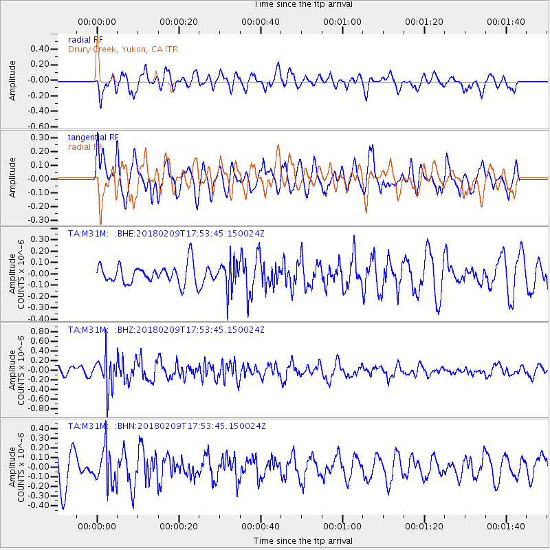
Signal To Noise
| Channel | StoN | STA | LTA |
| TA:M31M: :BHZ:20180209T17:53:45.150024Z | 2.7571611 | 3.1967133E-7 | 1.1594219E-7 |
| TA:M31M: :BHN:20180209T17:53:45.150024Z | 1.1373188 | 1.8261446E-7 | 1.6056575E-7 |
| TA:M31M: :BHE:20180209T17:53:45.150024Z | 1.5112964 | 1.2601704E-7 | 8.338341E-8 |
| Arrivals |
| Ps | |
| PpPs | |
| PsPs/PpSs | |


