You are here: Home > Network List > TA - USArray Transportable Network (new EarthScope stations) Stations List
> Station R32K Eaglecrest, AK, USA > Earthquake Result Viewer
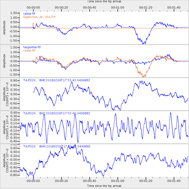
R32K Eaglecrest, AK, USA - Earthquake Result Viewer
*The percent match for this event was below the threshold and hence no stack was calculated.
| Earthquake location: |
Leeward Islands |
| Earthquake latitude/longitude: |
19.0/-61.7 |
| Earthquake time(UTC): |
2018/02/09 (040) 17:43:34 GMT |
| Earthquake Depth: |
9.9 km |
| Earthquake Magnitude: |
5.5 Mi |
| Earthquake Catalog/Contributor: |
NEIC PDE/pt |
|
| Network: |
TA USArray Transportable Network (new EarthScope stations) |
| Station: |
R32K Eaglecrest, AK, USA |
| Lat/Lon: |
58.27 N/134.52 W |
| Elevation: |
386 m |
|
| Distance: |
65.0 deg |
| Az: |
326.166 deg |
| Baz: |
94.257 deg |
| Ray Param: |
$rayparam |
*The percent match for this event was below the threshold and hence was not used in the summary stack. |
|
| Radial Match: |
19.3983 % |
| Radial Bump: |
400 |
| Transverse Match: |
15.606515 % |
| Transverse Bump: |
400 |
| SOD ConfigId: |
13570011 |
| Insert Time: |
2019-04-29 18:58:01.244 +0000 |
| GWidth: |
2.5 |
| Max Bumps: |
400 |
| Tol: |
0.001 |
|
Signal To Noise
| Channel | StoN | STA | LTA |
| TA:R32K: :BHZ:20180209T17:53:43.049988Z | 1.3620366 | 1.2756655E-7 | 9.3658684E-8 |
| TA:R32K: :BHN:20180209T17:53:43.049988Z | 1.6115572 | 6.8879024E-7 | 4.274066E-7 |
| TA:R32K: :BHE:20180209T17:53:43.049988Z | 1.4767846 | 4.6504283E-7 | 3.1490228E-7 |
| Arrivals |
| Ps | |
| PpPs | |
| PsPs/PpSs | |


