You are here: Home > Network List > TA - USArray Transportable Network (new EarthScope stations) Stations List
> Station B18K Kokolik River, AK, USA > Earthquake Result Viewer
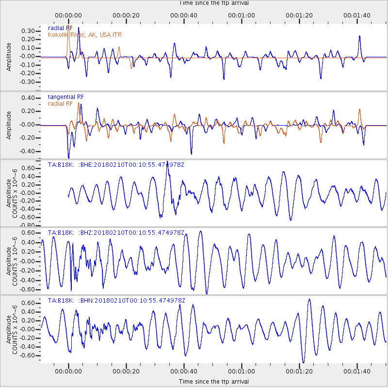
B18K Kokolik River, AK, USA - Earthquake Result Viewer
*The percent match for this event was below the threshold and hence no stack was calculated.
| Earthquake location: |
Fiji Islands Region |
| Earthquake latitude/longitude: |
-21.4/-179.3 |
| Earthquake time(UTC): |
2018/02/09 (040) 23:59:24 GMT |
| Earthquake Depth: |
610 km |
| Earthquake Magnitude: |
5.6 Mww |
| Earthquake Catalog/Contributor: |
NEIC PDE/us |
|
| Network: |
TA USArray Transportable Network (new EarthScope stations) |
| Station: |
B18K Kokolik River, AK, USA |
| Lat/Lon: |
69.36 N/161.80 W |
| Elevation: |
222 m |
|
| Distance: |
91.4 deg |
| Az: |
6.129 deg |
| Baz: |
196.297 deg |
| Ray Param: |
$rayparam |
*The percent match for this event was below the threshold and hence was not used in the summary stack. |
|
| Radial Match: |
56.899643 % |
| Radial Bump: |
400 |
| Transverse Match: |
55.25035 % |
| Transverse Bump: |
346 |
| SOD ConfigId: |
13570011 |
| Insert Time: |
2019-04-29 19:03:38.427 +0000 |
| GWidth: |
2.5 |
| Max Bumps: |
400 |
| Tol: |
0.001 |
|
Signal To Noise
| Channel | StoN | STA | LTA |
| TA:B18K: :BHZ:20180210T00:10:55.474978Z | 1.0233634 | 2.9566752E-7 | 2.8891742E-7 |
| TA:B18K: :BHN:20180210T00:10:55.474978Z | 1.1700318 | 3.103288E-7 | 2.6523108E-7 |
| TA:B18K: :BHE:20180210T00:10:55.474978Z | 2.0874536 | 4.2351547E-7 | 2.0288617E-7 |
| Arrivals |
| Ps | |
| PpPs | |
| PsPs/PpSs | |


