You are here: Home > Network List > AZ - ANZA Regional Network Stations List
> Station FRD AZ.FRD > Earthquake Result Viewer
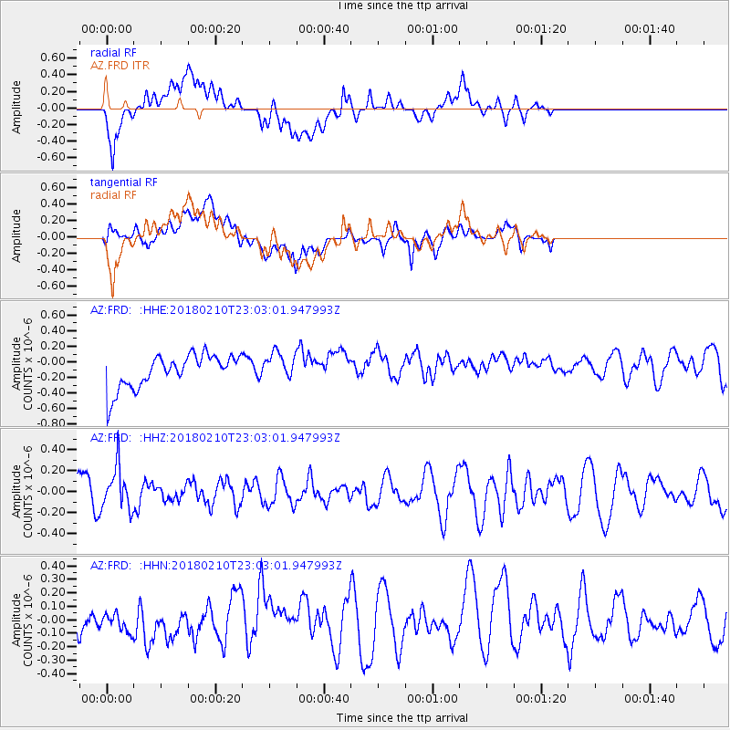
FRD AZ.FRD - Earthquake Result Viewer
*The percent match for this event was below the threshold and hence no stack was calculated.
| Earthquake location: |
New Ireland Region, P.N.G. |
| Earthquake latitude/longitude: |
-3.8/151.9 |
| Earthquake time(UTC): |
2018/02/10 (041) 22:50:48 GMT |
| Earthquake Depth: |
268 km |
| Earthquake Magnitude: |
5.8 Mww |
| Earthquake Catalog/Contributor: |
NEIC PDE/us |
|
| Network: |
AZ ANZA Regional Network |
| Station: |
FRD AZ.FRD |
| Lat/Lon: |
33.49 N/116.60 W |
| Elevation: |
1164 m |
|
| Distance: |
93.3 deg |
| Az: |
56.799 deg |
| Baz: |
267.651 deg |
| Ray Param: |
$rayparam |
*The percent match for this event was below the threshold and hence was not used in the summary stack. |
|
| Radial Match: |
64.366425 % |
| Radial Bump: |
400 |
| Transverse Match: |
49.564537 % |
| Transverse Bump: |
400 |
| SOD ConfigId: |
13570011 |
| Insert Time: |
2019-04-29 19:06:49.680 +0000 |
| GWidth: |
2.5 |
| Max Bumps: |
400 |
| Tol: |
0.001 |
|
Signal To Noise
| Channel | StoN | STA | LTA |
| AZ:FRD: :HHZ:20180210T23:03:01.947993Z | 1.5337477 | 2.0059548E-7 | 1.307878E-7 |
| AZ:FRD: :HHN:20180210T23:03:01.947993Z | 0.56457675 | 1.04613804E-7 | 1.8529599E-7 |
| AZ:FRD: :HHE:20180210T23:03:01.947993Z | 0.8239093 | 1.7881656E-7 | 2.1703427E-7 |
| Arrivals |
| Ps | |
| PpPs | |
| PsPs/PpSs | |


