You are here: Home > Network List > CI - Caltech Regional Seismic Network Stations List
> Station IRM Iron Mountain Pumping Station, Eagle Mtn., CA, USA > Earthquake Result Viewer
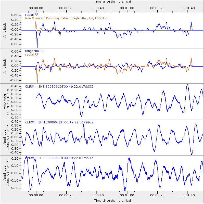
IRM Iron Mountain Pumping Station, Eagle Mtn., CA, USA - Earthquake Result Viewer
*The percent match for this event was below the threshold and hence no stack was calculated.
| Earthquake location: |
New Britain Region, P.N.G. |
| Earthquake latitude/longitude: |
-4.9/151.8 |
| Earthquake time(UTC): |
2008/06/19 (171) 00:36:45 GMT |
| Earthquake Depth: |
143 km |
| Earthquake Magnitude: |
5.5 MW, 5.2 MB, 5.4 MW |
| Earthquake Catalog/Contributor: |
WHDF/NEIC |
|
| Network: |
CI Caltech Regional Seismic Network |
| Station: |
IRM Iron Mountain Pumping Station, Eagle Mtn., CA, USA |
| Lat/Lon: |
34.16 N/115.15 W |
| Elevation: |
567 m |
|
| Distance: |
95.3 deg |
| Az: |
56.262 deg |
| Baz: |
267.658 deg |
| Ray Param: |
$rayparam |
*The percent match for this event was below the threshold and hence was not used in the summary stack. |
|
| Radial Match: |
71.35078 % |
| Radial Bump: |
400 |
| Transverse Match: |
49.69346 % |
| Transverse Bump: |
400 |
| SOD ConfigId: |
2504 |
| Insert Time: |
2010-02-26 01:48:34.007 +0000 |
| GWidth: |
2.5 |
| Max Bumps: |
400 |
| Tol: |
0.001 |
|
Signal To Noise
| Channel | StoN | STA | LTA |
| CI:IRM: :BHN:20080619T00:49:22.017993Z | 1.7967988 | 1.6304783E-7 | 9.0743505E-8 |
| CI:IRM: :BHE:20080619T00:49:22.017993Z | 0.99070007 | 1.0927633E-7 | 1.1030213E-7 |
| CI:IRM: :BHZ:20080619T00:49:22.017993Z | 2.498442 | 2.1253284E-7 | 8.506615E-8 |
| Arrivals |
| Ps | |
| PpPs | |
| PsPs/PpSs | |


