You are here: Home > Network List > TA - USArray Transportable Network (new EarthScope stations) Stations List
> Station POKR Poker Plat Research Range, AK, USA > Earthquake Result Viewer
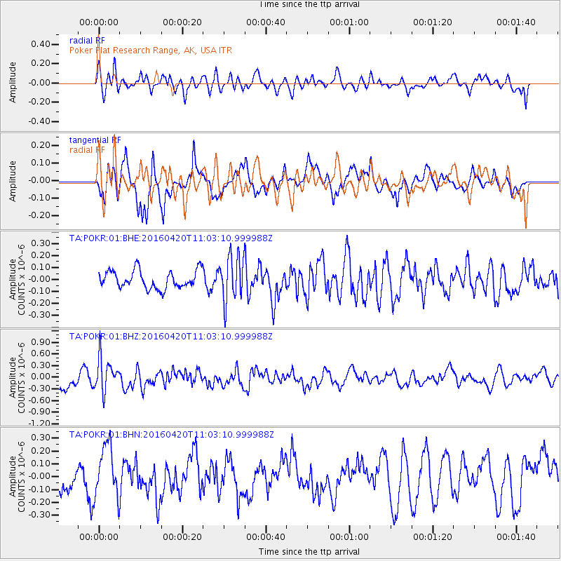
POKR Poker Plat Research Range, AK, USA - Earthquake Result Viewer
*The percent match for this event was below the threshold and hence no stack was calculated.
| Earthquake location: |
North Atlantic Ocean |
| Earthquake latitude/longitude: |
13.2/-55.9 |
| Earthquake time(UTC): |
2016/04/20 (111) 10:51:39 GMT |
| Earthquake Depth: |
10 km |
| Earthquake Magnitude: |
5.8 MB |
| Earthquake Catalog/Contributor: |
NEIC PDE/NEIC COMCAT |
|
| Network: |
TA USArray Transportable Network (new EarthScope stations) |
| Station: |
POKR Poker Plat Research Range, AK, USA |
| Lat/Lon: |
65.12 N/147.43 W |
| Elevation: |
501 m |
|
| Distance: |
78.8 deg |
| Az: |
334.456 deg |
| Baz: |
83.018 deg |
| Ray Param: |
$rayparam |
*The percent match for this event was below the threshold and hence was not used in the summary stack. |
|
| Radial Match: |
60.700523 % |
| Radial Bump: |
400 |
| Transverse Match: |
69.01953 % |
| Transverse Bump: |
400 |
| SOD ConfigId: |
1475611 |
| Insert Time: |
2016-05-04 11:04:31.734 +0000 |
| GWidth: |
2.5 |
| Max Bumps: |
400 |
| Tol: |
0.001 |
|
Signal To Noise
| Channel | StoN | STA | LTA |
| TA:POKR:01:BHZ:20160420T11:03:10.999988Z | 2.889757 | 4.431963E-7 | 1.5336802E-7 |
| TA:POKR:01:BHN:20160420T11:03:10.999988Z | 2.0760312 | 2.095913E-7 | 1.00957685E-7 |
| TA:POKR:01:BHE:20160420T11:03:10.999988Z | 2.5646913 | 1.9209502E-7 | 7.489986E-8 |
| Arrivals |
| Ps | |
| PpPs | |
| PsPs/PpSs | |


