You are here: Home > Network List > TA - USArray Transportable Network (new EarthScope stations) Stations List
> Station F26K Sheenjek River, AK, USA > Earthquake Result Viewer
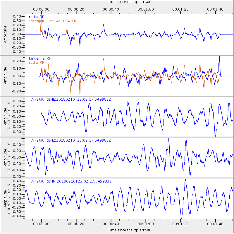
F26K Sheenjek River, AK, USA - Earthquake Result Viewer
*The percent match for this event was below the threshold and hence no stack was calculated.
| Earthquake location: |
New Ireland Region, P.N.G. |
| Earthquake latitude/longitude: |
-3.8/151.9 |
| Earthquake time(UTC): |
2018/02/10 (041) 22:50:48 GMT |
| Earthquake Depth: |
268 km |
| Earthquake Magnitude: |
5.8 Mww |
| Earthquake Catalog/Contributor: |
NEIC PDE/us |
|
| Network: |
TA USArray Transportable Network (new EarthScope stations) |
| Station: |
F26K Sheenjek River, AK, USA |
| Lat/Lon: |
67.69 N/144.15 W |
| Elevation: |
683 m |
|
| Distance: |
83.9 deg |
| Az: |
20.174 deg |
| Baz: |
244.353 deg |
| Ray Param: |
$rayparam |
*The percent match for this event was below the threshold and hence was not used in the summary stack. |
|
| Radial Match: |
61.3883 % |
| Radial Bump: |
328 |
| Transverse Match: |
44.412262 % |
| Transverse Bump: |
400 |
| SOD ConfigId: |
13570011 |
| Insert Time: |
2019-04-29 19:09:39.205 +0000 |
| GWidth: |
2.5 |
| Max Bumps: |
400 |
| Tol: |
0.001 |
|
Signal To Noise
| Channel | StoN | STA | LTA |
| TA:F26K: :BHZ:20180210T23:02:17.549983Z | 1.693363 | 2.9831472E-7 | 1.7616702E-7 |
| TA:F26K: :BHN:20180210T23:02:17.549983Z | 0.9817209 | 1.2298575E-7 | 1.2527568E-7 |
| TA:F26K: :BHE:20180210T23:02:17.549983Z | 1.3515649 | 9.1783285E-8 | 6.79089E-8 |
| Arrivals |
| Ps | |
| PpPs | |
| PsPs/PpSs | |


