You are here: Home > Network List > TA - USArray Transportable Network (new EarthScope stations) Stations List
> Station H16K Elim, AK, USA > Earthquake Result Viewer
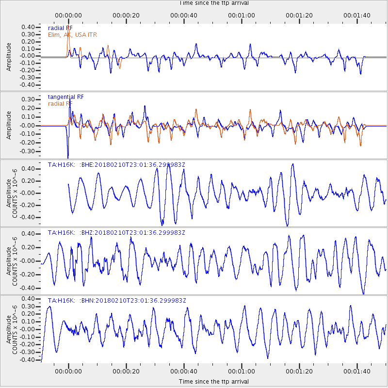
H16K Elim, AK, USA - Earthquake Result Viewer
*The percent match for this event was below the threshold and hence no stack was calculated.
| Earthquake location: |
New Ireland Region, P.N.G. |
| Earthquake latitude/longitude: |
-3.8/151.9 |
| Earthquake time(UTC): |
2018/02/10 (041) 22:50:48 GMT |
| Earthquake Depth: |
268 km |
| Earthquake Magnitude: |
5.8 Mww |
| Earthquake Catalog/Contributor: |
NEIC PDE/us |
|
| Network: |
TA USArray Transportable Network (new EarthScope stations) |
| Station: |
H16K Elim, AK, USA |
| Lat/Lon: |
64.64 N/162.24 W |
| Elevation: |
216 m |
|
| Distance: |
76.1 deg |
| Az: |
18.559 deg |
| Baz: |
227.511 deg |
| Ray Param: |
$rayparam |
*The percent match for this event was below the threshold and hence was not used in the summary stack. |
|
| Radial Match: |
47.62924 % |
| Radial Bump: |
336 |
| Transverse Match: |
43.42733 % |
| Transverse Bump: |
400 |
| SOD ConfigId: |
13570011 |
| Insert Time: |
2019-04-29 19:09:41.841 +0000 |
| GWidth: |
2.5 |
| Max Bumps: |
400 |
| Tol: |
0.001 |
|
Signal To Noise
| Channel | StoN | STA | LTA |
| TA:H16K: :BHZ:20180210T23:01:36.299983Z | 1.1517218 | 1.8232795E-7 | 1.58309E-7 |
| TA:H16K: :BHN:20180210T23:01:36.299983Z | 0.26642257 | 4.797911E-8 | 1.8008652E-7 |
| TA:H16K: :BHE:20180210T23:01:36.299983Z | 2.0734284 | 3.3593815E-7 | 1.6202061E-7 |
| Arrivals |
| Ps | |
| PpPs | |
| PsPs/PpSs | |


