You are here: Home > Network List > UW - Pacific Northwest Regional Seismic Network Stations List
> Station FISH Seaside, OR, USA > Earthquake Result Viewer
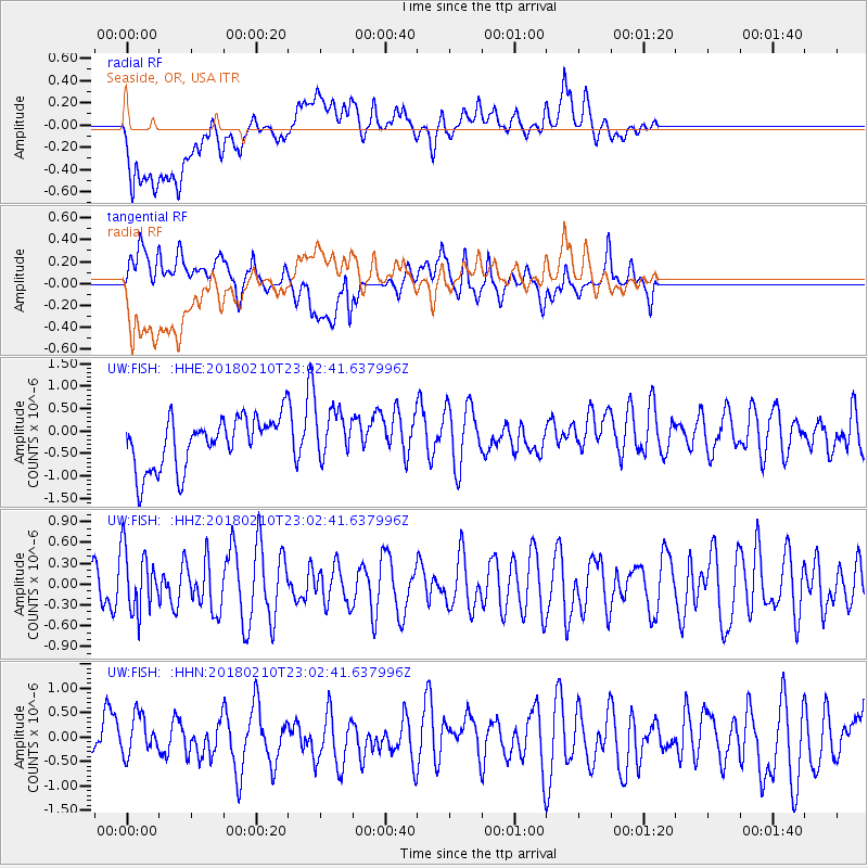
FISH Seaside, OR, USA - Earthquake Result Viewer
*The percent match for this event was below the threshold and hence no stack was calculated.
| Earthquake location: |
New Ireland Region, P.N.G. |
| Earthquake latitude/longitude: |
-3.8/151.9 |
| Earthquake time(UTC): |
2018/02/10 (041) 22:50:48 GMT |
| Earthquake Depth: |
268 km |
| Earthquake Magnitude: |
5.8 Mww |
| Earthquake Catalog/Contributor: |
NEIC PDE/us |
|
| Network: |
UW Pacific Northwest Regional Seismic Network |
| Station: |
FISH Seaside, OR, USA |
| Lat/Lon: |
45.93 N/123.56 W |
| Elevation: |
325 m |
|
| Distance: |
88.9 deg |
| Az: |
44.018 deg |
| Baz: |
263.441 deg |
| Ray Param: |
$rayparam |
*The percent match for this event was below the threshold and hence was not used in the summary stack. |
|
| Radial Match: |
45.050938 % |
| Radial Bump: |
400 |
| Transverse Match: |
47.88669 % |
| Transverse Bump: |
400 |
| SOD ConfigId: |
13570011 |
| Insert Time: |
2019-04-29 19:10:33.967 +0000 |
| GWidth: |
2.5 |
| Max Bumps: |
400 |
| Tol: |
0.001 |
|
Signal To Noise
| Channel | StoN | STA | LTA |
| UW:FISH: :HHZ:20180210T23:02:41.637996Z | 1.5167022 | 4.503185E-7 | 2.9690636E-7 |
| UW:FISH: :HHN:20180210T23:02:41.637996Z | 0.6285084 | 4.4078297E-7 | 7.0131597E-7 |
| UW:FISH: :HHE:20180210T23:02:41.637996Z | 1.0201598 | 5.750762E-7 | 5.6371186E-7 |
| Arrivals |
| Ps | |
| PpPs | |
| PsPs/PpSs | |


