You are here: Home > Network List > UW - Pacific Northwest Regional Seismic Network Stations List
> Station LON Longmire CREST broad-band > Earthquake Result Viewer
LON Longmire CREST broad-band - Earthquake Result Viewer
*The percent match for this event was below the threshold and hence no stack was calculated.
| Earthquake location: |
New Ireland Region, P.N.G. |
| Earthquake latitude/longitude: |
-3.8/151.9 |
| Earthquake time(UTC): |
2018/02/10 (041) 22:50:48 GMT |
| Earthquake Depth: |
268 km |
| Earthquake Magnitude: |
5.8 Mww |
| Earthquake Catalog/Contributor: |
NEIC PDE/us |
|
| Network: |
UW Pacific Northwest Regional Seismic Network |
| Station: |
LON Longmire CREST broad-band |
| Lat/Lon: |
46.75 N/121.81 W |
| Elevation: |
853 m |
|
| Distance: |
90.2 deg |
| Az: |
43.327 deg |
| Baz: |
264.697 deg |
| Ray Param: |
$rayparam |
*The percent match for this event was below the threshold and hence was not used in the summary stack. |
|
| Radial Match: |
57.14665 % |
| Radial Bump: |
335 |
| Transverse Match: |
54.67844 % |
| Transverse Bump: |
400 |
| SOD ConfigId: |
13570011 |
| Insert Time: |
2019-04-29 19:10:36.728 +0000 |
| GWidth: |
2.5 |
| Max Bumps: |
400 |
| Tol: |
0.001 |
|
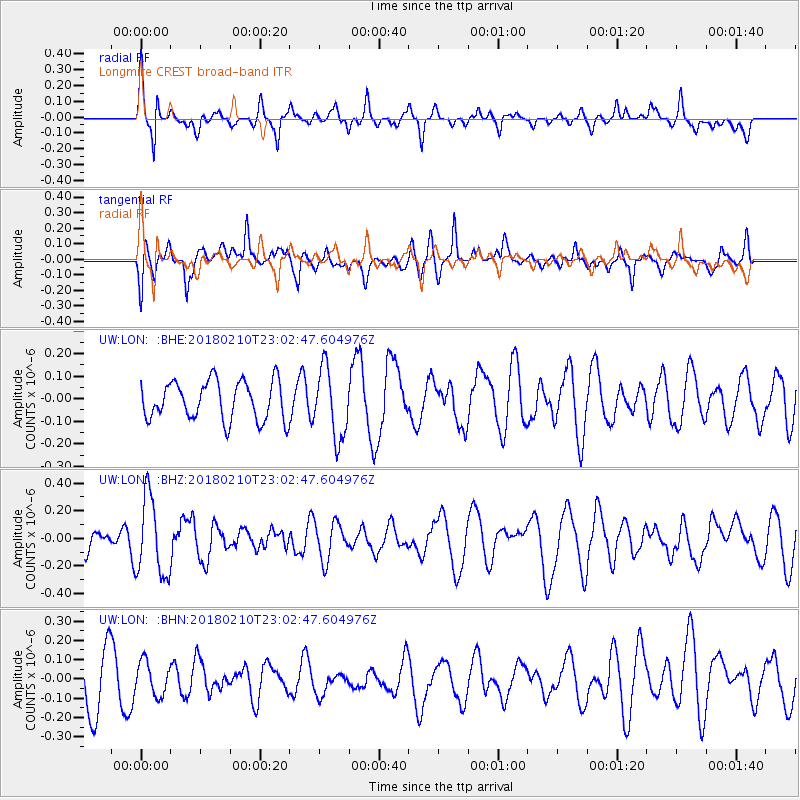
Signal To Noise
| Channel | StoN | STA | LTA |
| UW:LON: :BHZ:20180210T23:02:47.604976Z | 3.6509519 | 2.85109E-7 | 7.809169E-8 |
| UW:LON: :BHN:20180210T23:02:47.604976Z | 0.71431106 | 8.6190376E-8 | 1.2066225E-7 |
| UW:LON: :BHE:20180210T23:02:47.604976Z | 1.8081372 | 1.5484217E-7 | 8.5636295E-8 |
| Arrivals |
| Ps | |
| PpPs | |
| PsPs/PpSs | |


