You are here: Home > Network List > AZ - ANZA Regional Network Stations List
> Station LVA2 AZ.LVA2 > Earthquake Result Viewer
LVA2 AZ.LVA2 - Earthquake Result Viewer
*The percent match for this event was below the threshold and hence no stack was calculated.
| Earthquake location: |
Near Coast Of Peru |
| Earthquake latitude/longitude: |
-16.7/-74.2 |
| Earthquake time(UTC): |
2018/02/11 (042) 04:11:09 GMT |
| Earthquake Depth: |
10 km |
| Earthquake Magnitude: |
5.4 Mww |
| Earthquake Catalog/Contributor: |
NEIC PDE/us |
|
| Network: |
AZ ANZA Regional Network |
| Station: |
LVA2 AZ.LVA2 |
| Lat/Lon: |
33.35 N/116.56 W |
| Elevation: |
1435 m |
|
| Distance: |
64.1 deg |
| Az: |
321.154 deg |
| Baz: |
134.093 deg |
| Ray Param: |
$rayparam |
*The percent match for this event was below the threshold and hence was not used in the summary stack. |
|
| Radial Match: |
39.028103 % |
| Radial Bump: |
400 |
| Transverse Match: |
44.66701 % |
| Transverse Bump: |
400 |
| SOD ConfigId: |
13570011 |
| Insert Time: |
2019-04-29 19:11:51.599 +0000 |
| GWidth: |
2.5 |
| Max Bumps: |
400 |
| Tol: |
0.001 |
|
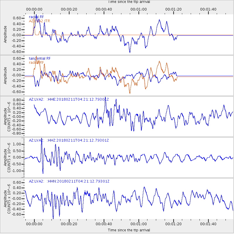
Signal To Noise
| Channel | StoN | STA | LTA |
| AZ:LVA2: :HHZ:20180211T04:21:12.79301Z | 3.128108 | 4.1790304E-7 | 1.335961E-7 |
| AZ:LVA2: :HHN:20180211T04:21:12.79301Z | 0.72744757 | 1.311418E-7 | 1.8027664E-7 |
| AZ:LVA2: :HHE:20180211T04:21:12.79301Z | 1.0681702 | 2.3458094E-7 | 2.1961009E-7 |
| Arrivals |
| Ps | |
| PpPs | |
| PsPs/PpSs | |


