You are here: Home > Network List > CI - Caltech Regional Seismic Network Stations List
> Station SMM Simmler, CA, USA > Earthquake Result Viewer
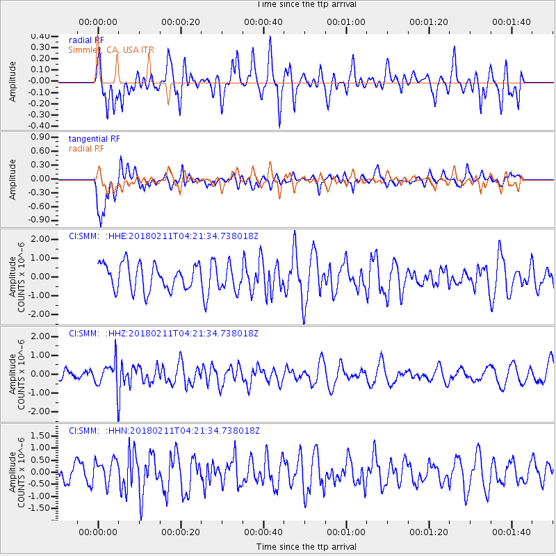
SMM Simmler, CA, USA - Earthquake Result Viewer
*The percent match for this event was below the threshold and hence no stack was calculated.
| Earthquake location: |
Near Coast Of Peru |
| Earthquake latitude/longitude: |
-16.7/-74.2 |
| Earthquake time(UTC): |
2018/02/11 (042) 04:11:09 GMT |
| Earthquake Depth: |
10 km |
| Earthquake Magnitude: |
5.4 Mww |
| Earthquake Catalog/Contributor: |
NEIC PDE/us |
|
| Network: |
CI Caltech Regional Seismic Network |
| Station: |
SMM Simmler, CA, USA |
| Lat/Lon: |
35.31 N/120.00 W |
| Elevation: |
599 m |
|
| Distance: |
67.6 deg |
| Az: |
320.598 deg |
| Baz: |
131.936 deg |
| Ray Param: |
$rayparam |
*The percent match for this event was below the threshold and hence was not used in the summary stack. |
|
| Radial Match: |
45.277878 % |
| Radial Bump: |
400 |
| Transverse Match: |
64.839676 % |
| Transverse Bump: |
400 |
| SOD ConfigId: |
13570011 |
| Insert Time: |
2019-04-29 19:12:47.447 +0000 |
| GWidth: |
2.5 |
| Max Bumps: |
400 |
| Tol: |
0.001 |
|
Signal To Noise
| Channel | StoN | STA | LTA |
| CI:SMM: :HHZ:20180211T04:21:34.738018Z | 2.4960873 | 7.1283625E-7 | 2.8558148E-7 |
| CI:SMM: :HHN:20180211T04:21:34.738018Z | 0.9431517 | 4.988021E-7 | 5.2886725E-7 |
| CI:SMM: :HHE:20180211T04:21:34.738018Z | 0.954593 | 6.4815464E-7 | 6.789853E-7 |
| Arrivals |
| Ps | |
| PpPs | |
| PsPs/PpSs | |


