You are here: Home > Network List > LD - Lamont-Doherty Cooperative Seismographic Network Stations List
> Station MVL Millersville University, PA > Earthquake Result Viewer
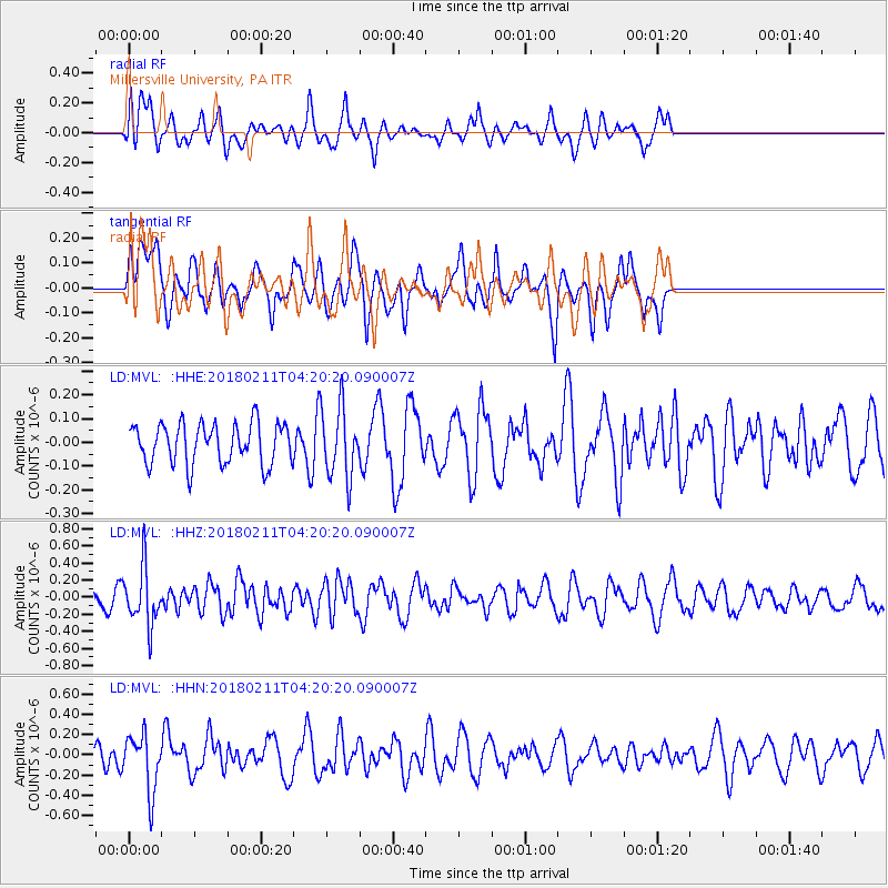
MVL Millersville University, PA - Earthquake Result Viewer
*The percent match for this event was below the threshold and hence no stack was calculated.
| Earthquake location: |
Near Coast Of Peru |
| Earthquake latitude/longitude: |
-16.7/-74.2 |
| Earthquake time(UTC): |
2018/02/11 (042) 04:11:09 GMT |
| Earthquake Depth: |
10 km |
| Earthquake Magnitude: |
5.4 Mww |
| Earthquake Catalog/Contributor: |
NEIC PDE/us |
|
| Network: |
LD Lamont-Doherty Cooperative Seismographic Network |
| Station: |
MVL Millersville University, PA |
| Lat/Lon: |
40.00 N/76.35 W |
| Elevation: |
91 m |
|
| Distance: |
56.4 deg |
| Az: |
357.98 deg |
| Baz: |
177.48 deg |
| Ray Param: |
$rayparam |
*The percent match for this event was below the threshold and hence was not used in the summary stack. |
|
| Radial Match: |
61.202145 % |
| Radial Bump: |
400 |
| Transverse Match: |
66.490486 % |
| Transverse Bump: |
400 |
| SOD ConfigId: |
13570011 |
| Insert Time: |
2019-04-29 19:14:12.960 +0000 |
| GWidth: |
2.5 |
| Max Bumps: |
400 |
| Tol: |
0.001 |
|
Signal To Noise
| Channel | StoN | STA | LTA |
| LD:MVL: :HHZ:20180211T04:20:20.090007Z | 1.7746905 | 3.3220067E-7 | 1.8718795E-7 |
| LD:MVL: :HHN:20180211T04:20:20.090007Z | 2.4442797 | 2.797734E-7 | 1.1446047E-7 |
| LD:MVL: :HHE:20180211T04:20:20.090007Z | 1.7234507 | 1.4567794E-7 | 8.45269E-8 |
| Arrivals |
| Ps | |
| PpPs | |
| PsPs/PpSs | |


