You are here: Home > Network List > US - United States National Seismic Network Stations List
> Station ELK Elko, Nevada, USA > Earthquake Result Viewer
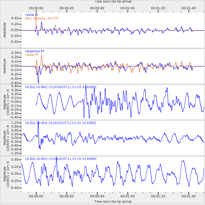
ELK Elko, Nevada, USA - Earthquake Result Viewer
*The percent match for this event was below the threshold and hence no stack was calculated.
| Earthquake location: |
North Atlantic Ocean |
| Earthquake latitude/longitude: |
13.2/-55.9 |
| Earthquake time(UTC): |
2016/04/20 (111) 10:51:39 GMT |
| Earthquake Depth: |
10 km |
| Earthquake Magnitude: |
5.8 MB |
| Earthquake Catalog/Contributor: |
NEIC PDE/NEIC COMCAT |
|
| Network: |
US United States National Seismic Network |
| Station: |
ELK Elko, Nevada, USA |
| Lat/Lon: |
40.74 N/115.24 W |
| Elevation: |
2210 m |
|
| Distance: |
58.3 deg |
| Az: |
309.842 deg |
| Baz: |
100.202 deg |
| Ray Param: |
$rayparam |
*The percent match for this event was below the threshold and hence was not used in the summary stack. |
|
| Radial Match: |
61.773354 % |
| Radial Bump: |
400 |
| Transverse Match: |
79.79912 % |
| Transverse Bump: |
394 |
| SOD ConfigId: |
1475611 |
| Insert Time: |
2016-05-04 11:06:40.520 +0000 |
| GWidth: |
2.5 |
| Max Bumps: |
400 |
| Tol: |
0.001 |
|
Signal To Noise
| Channel | StoN | STA | LTA |
| US:ELK:00:BHZ:20160420T11:01:03.624988Z | 1.5432932 | 5.0246564E-7 | 3.2558015E-7 |
| US:ELK:00:BH1:20160420T11:01:03.624988Z | 0.63700104 | 1.6535108E-7 | 2.595774E-7 |
| US:ELK:00:BH2:20160420T11:01:03.624988Z | 1.3544356 | 2.0087468E-7 | 1.4830877E-7 |
| Arrivals |
| Ps | |
| PpPs | |
| PsPs/PpSs | |


