You are here: Home > Network List > US - United States National Seismic Network Stations List
> Station EGMT Eagleton, Montana, USA > Earthquake Result Viewer
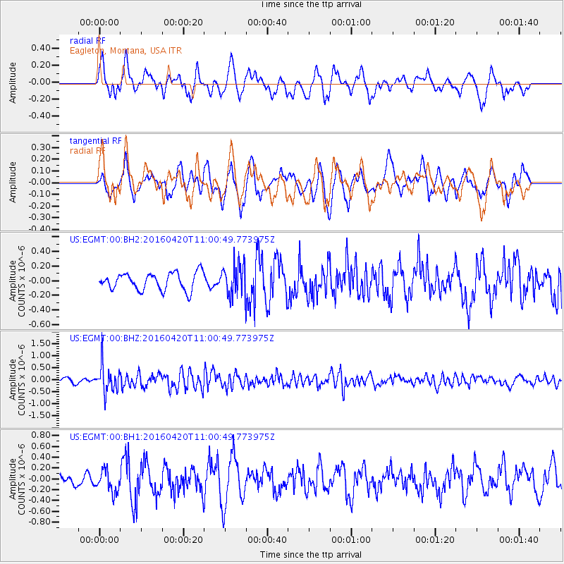
EGMT Eagleton, Montana, USA - Earthquake Result Viewer
*The percent match for this event was below the threshold and hence no stack was calculated.
| Earthquake location: |
North Atlantic Ocean |
| Earthquake latitude/longitude: |
13.2/-55.9 |
| Earthquake time(UTC): |
2016/04/20 (111) 10:51:39 GMT |
| Earthquake Depth: |
10 km |
| Earthquake Magnitude: |
5.8 MB |
| Earthquake Catalog/Contributor: |
NEIC PDE/NEIC COMCAT |
|
| Network: |
US United States National Seismic Network |
| Station: |
EGMT Eagleton, Montana, USA |
| Lat/Lon: |
48.02 N/109.75 W |
| Elevation: |
1055 m |
|
| Distance: |
56.4 deg |
| Az: |
319.385 deg |
| Baz: |
109.193 deg |
| Ray Param: |
$rayparam |
*The percent match for this event was below the threshold and hence was not used in the summary stack. |
|
| Radial Match: |
64.44212 % |
| Radial Bump: |
400 |
| Transverse Match: |
61.569405 % |
| Transverse Bump: |
400 |
| SOD ConfigId: |
1475611 |
| Insert Time: |
2016-05-04 11:06:47.076 +0000 |
| GWidth: |
2.5 |
| Max Bumps: |
400 |
| Tol: |
0.001 |
|
Signal To Noise
| Channel | StoN | STA | LTA |
| US:EGMT:00:BHZ:20160420T11:00:49.773975Z | 4.1128902 | 5.708982E-7 | 1.3880705E-7 |
| US:EGMT:00:BH1:20160420T11:00:49.773975Z | 1.2930368 | 2.0112405E-7 | 1.5554394E-7 |
| US:EGMT:00:BH2:20160420T11:00:49.773975Z | 1.8166461 | 2.145068E-7 | 1.18078475E-7 |
| Arrivals |
| Ps | |
| PpPs | |
| PsPs/PpSs | |


