You are here: Home > Network List > TA - USArray Transportable Network (new EarthScope stations) Stations List
> Station MSTX Muleshoe, TX, USA > Earthquake Result Viewer
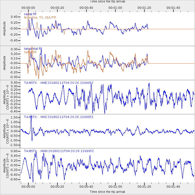
MSTX Muleshoe, TX, USA - Earthquake Result Viewer
*The percent match for this event was below the threshold and hence no stack was calculated.
| Earthquake location: |
Near Coast Of Peru |
| Earthquake latitude/longitude: |
-16.7/-74.2 |
| Earthquake time(UTC): |
2018/02/11 (042) 04:11:09 GMT |
| Earthquake Depth: |
10 km |
| Earthquake Magnitude: |
5.4 Mww |
| Earthquake Catalog/Contributor: |
NEIC PDE/us |
|
| Network: |
TA USArray Transportable Network (new EarthScope stations) |
| Station: |
MSTX Muleshoe, TX, USA |
| Lat/Lon: |
33.97 N/102.77 W |
| Elevation: |
1167 m |
|
| Distance: |
57.3 deg |
| Az: |
331.768 deg |
| Baz: |
146.939 deg |
| Ray Param: |
$rayparam |
*The percent match for this event was below the threshold and hence was not used in the summary stack. |
|
| Radial Match: |
67.51425 % |
| Radial Bump: |
400 |
| Transverse Match: |
57.66951 % |
| Transverse Bump: |
400 |
| SOD ConfigId: |
13570011 |
| Insert Time: |
2019-04-29 19:17:37.336 +0000 |
| GWidth: |
2.5 |
| Max Bumps: |
400 |
| Tol: |
0.001 |
|
Signal To Noise
| Channel | StoN | STA | LTA |
| TA:MSTX: :HHZ:20180211T04:20:26.139995Z | 2.6591194 | 5.63812E-7 | 2.120296E-7 |
| TA:MSTX: :HHN:20180211T04:20:26.139995Z | 1.5662531 | 3.638056E-7 | 2.3227767E-7 |
| TA:MSTX: :HHE:20180211T04:20:26.139995Z | 1.0649594 | 1.6258565E-7 | 1.526684E-7 |
| Arrivals |
| Ps | |
| PpPs | |
| PsPs/PpSs | |


