You are here: Home > Network List > CI - Caltech Regional Seismic Network Stations List
> Station LRL Laurel Mtn Radio Fac, Ridgecrest, CA, USA > Earthquake Result Viewer
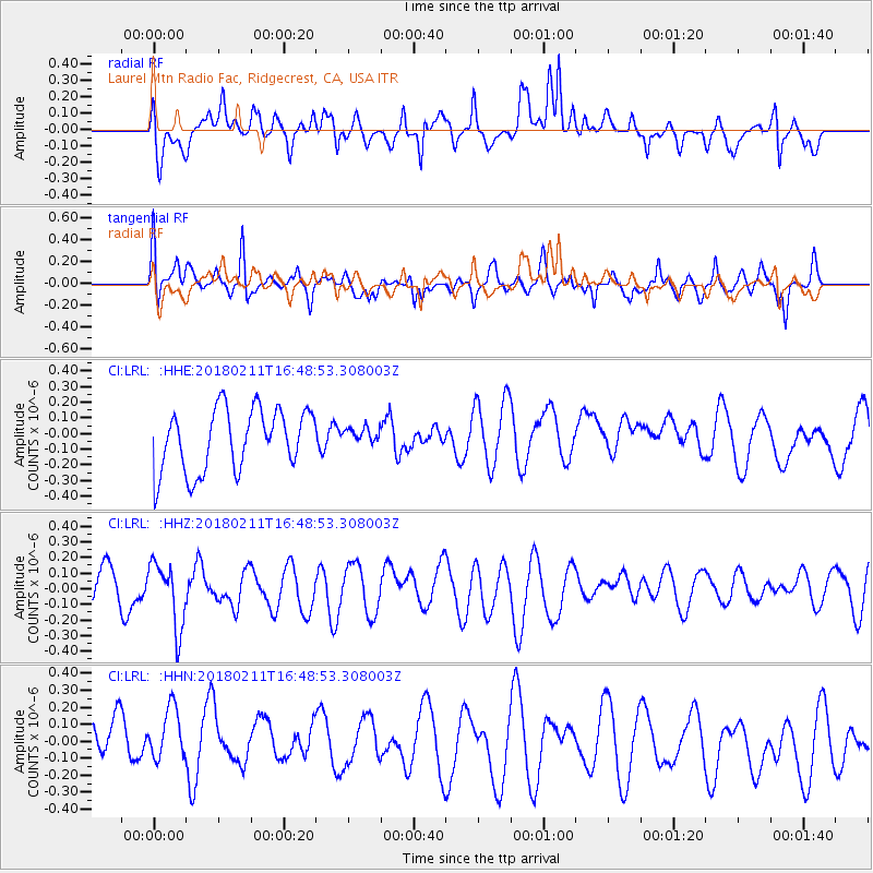
LRL Laurel Mtn Radio Fac, Ridgecrest, CA, USA - Earthquake Result Viewer
*The percent match for this event was below the threshold and hence no stack was calculated.
| Earthquake location: |
Fiji Islands Region |
| Earthquake latitude/longitude: |
-20.9/-179.1 |
| Earthquake time(UTC): |
2018/02/11 (042) 16:38:14 GMT |
| Earthquake Depth: |
631 km |
| Earthquake Magnitude: |
5.5 Mww |
| Earthquake Catalog/Contributor: |
NEIC PDE/us |
|
| Network: |
CI Caltech Regional Seismic Network |
| Station: |
LRL Laurel Mtn Radio Fac, Ridgecrest, CA, USA |
| Lat/Lon: |
35.48 N/117.68 W |
| Elevation: |
1340 m |
|
| Distance: |
80.8 deg |
| Az: |
46.574 deg |
| Baz: |
236.295 deg |
| Ray Param: |
$rayparam |
*The percent match for this event was below the threshold and hence was not used in the summary stack. |
|
| Radial Match: |
48.237076 % |
| Radial Bump: |
400 |
| Transverse Match: |
68.38765 % |
| Transverse Bump: |
400 |
| SOD ConfigId: |
13570011 |
| Insert Time: |
2019-04-29 19:21:03.513 +0000 |
| GWidth: |
2.5 |
| Max Bumps: |
400 |
| Tol: |
0.001 |
|
Signal To Noise
| Channel | StoN | STA | LTA |
| CI:LRL: :HHZ:20180211T16:48:53.308003Z | 1.5146759 | 2.0828416E-7 | 1.3751072E-7 |
| CI:LRL: :HHN:20180211T16:48:53.308003Z | 0.8408998 | 1.8649526E-7 | 2.217806E-7 |
| CI:LRL: :HHE:20180211T16:48:53.308003Z | 0.27486405 | 5.409155E-8 | 1.9679383E-7 |
| Arrivals |
| Ps | |
| PpPs | |
| PsPs/PpSs | |


