You are here: Home > Network List > TA - USArray Transportable Network (new EarthScope stations) Stations List
> Station E18K Tukpahlearik Creek, AK, USA > Earthquake Result Viewer
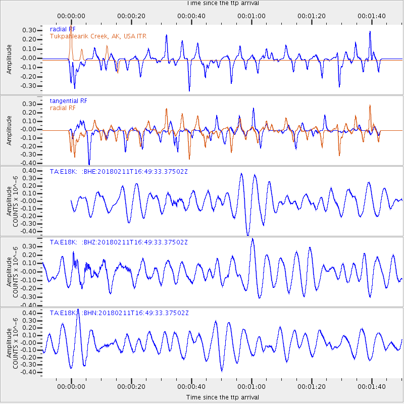
E18K Tukpahlearik Creek, AK, USA - Earthquake Result Viewer
*The percent match for this event was below the threshold and hence no stack was calculated.
| Earthquake location: |
Fiji Islands Region |
| Earthquake latitude/longitude: |
-20.9/-179.1 |
| Earthquake time(UTC): |
2018/02/11 (042) 16:38:14 GMT |
| Earthquake Depth: |
631 km |
| Earthquake Magnitude: |
5.5 Mww |
| Earthquake Catalog/Contributor: |
NEIC PDE/us |
|
| Network: |
TA USArray Transportable Network (new EarthScope stations) |
| Station: |
E18K Tukpahlearik Creek, AK, USA |
| Lat/Lon: |
67.42 N/160.60 W |
| Elevation: |
297 m |
|
| Distance: |
89.1 deg |
| Az: |
7.052 deg |
| Baz: |
197.292 deg |
| Ray Param: |
$rayparam |
*The percent match for this event was below the threshold and hence was not used in the summary stack. |
|
| Radial Match: |
59.267258 % |
| Radial Bump: |
324 |
| Transverse Match: |
56.393574 % |
| Transverse Bump: |
235 |
| SOD ConfigId: |
13570011 |
| Insert Time: |
2019-04-29 19:23:11.553 +0000 |
| GWidth: |
2.5 |
| Max Bumps: |
400 |
| Tol: |
0.001 |
|
Signal To Noise
| Channel | StoN | STA | LTA |
| TA:E18K: :BHZ:20180211T16:49:33.37502Z | 0.6625005 | 1.2526205E-7 | 1.8907465E-7 |
| TA:E18K: :BHN:20180211T16:49:33.37502Z | 2.2551856 | 2.7169713E-7 | 1.2047663E-7 |
| TA:E18K: :BHE:20180211T16:49:33.37502Z | 0.6613443 | 8.2381824E-8 | 1.2456722E-7 |
| Arrivals |
| Ps | |
| PpPs | |
| PsPs/PpSs | |


