You are here: Home > Network List > AK - Alaska Regional Network Stations List
> Station CUT Chulitna, AK, USA > Earthquake Result Viewer
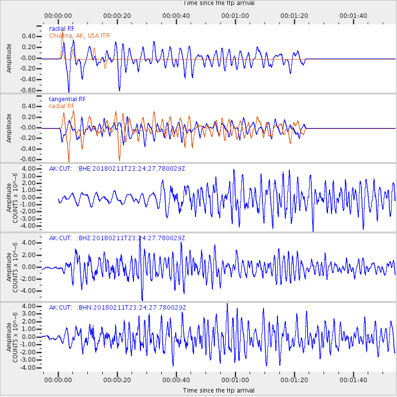
CUT Chulitna, AK, USA - Earthquake Result Viewer
*The percent match for this event was below the threshold and hence no stack was calculated.
| Earthquake location: |
South Of Mariana Islands |
| Earthquake latitude/longitude: |
13.8/146.5 |
| Earthquake time(UTC): |
2018/02/11 (042) 23:14:18 GMT |
| Earthquake Depth: |
42 km |
| Earthquake Magnitude: |
6.2 Mi |
| Earthquake Catalog/Contributor: |
NEIC PDE/pt |
|
| Network: |
AK Alaska Regional Network |
| Station: |
CUT Chulitna, AK, USA |
| Lat/Lon: |
62.41 N/150.26 W |
| Elevation: |
574 m |
|
| Distance: |
65.5 deg |
| Az: |
27.174 deg |
| Baz: |
252.302 deg |
| Ray Param: |
$rayparam |
*The percent match for this event was below the threshold and hence was not used in the summary stack. |
|
| Radial Match: |
64.40499 % |
| Radial Bump: |
400 |
| Transverse Match: |
61.229874 % |
| Transverse Bump: |
400 |
| SOD ConfigId: |
13570011 |
| Insert Time: |
2019-04-29 19:25:51.457 +0000 |
| GWidth: |
2.5 |
| Max Bumps: |
400 |
| Tol: |
0.001 |
|
Signal To Noise
| Channel | StoN | STA | LTA |
| AK:CUT: :BHZ:20180211T23:24:27.780029Z | 2.7416513 | 6.9244356E-7 | 2.525644E-7 |
| AK:CUT: :BHN:20180211T23:24:27.780029Z | 1.3633857 | 7.077909E-7 | 5.191421E-7 |
| AK:CUT: :BHE:20180211T23:24:27.780029Z | 1.1258175 | 5.869906E-7 | 5.213906E-7 |
| Arrivals |
| Ps | |
| PpPs | |
| PsPs/PpSs | |


