
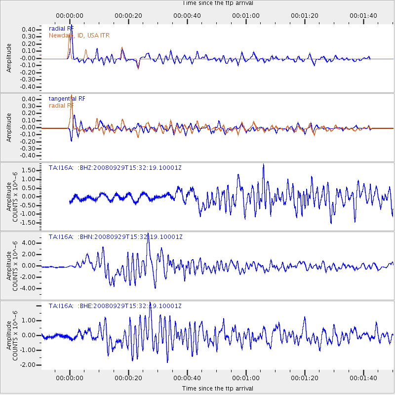
I16A Newdale, ID, USA - Earthquake Result Viewer
| ||||||||||||||||||
| ||||||||||||||||||
| ||||||||||||||||||
|
Signal To Noise
| Channel | StoN | STA | LTA |
| TA:I16A: :BHN:20080929T15:32:19.10001Z | 5.0478134 | 3.967909E-7 | 7.860649E-8 |
| TA:I16A: :BHE:20080929T15:32:19.10001Z | 1.7198418 | 1.9446632E-7 | 1.1307222E-7 |
| TA:I16A: :BHZ:20080929T15:32:19.10001Z | 0.8446194 | 1.3311836E-7 | 1.5760752E-7 |
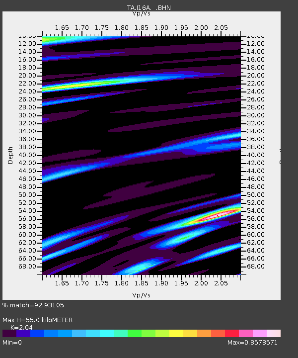
| Arrivals | |
| Ps | 9.4 SECOND |
| PpPs | 27 SECOND |
| PsPs/PpSs | 36 SECOND |

