You are here: Home > Network List > CI - Caltech Regional Seismic Network Stations List
> Station SMM Simmler, CA, USA > Earthquake Result Viewer
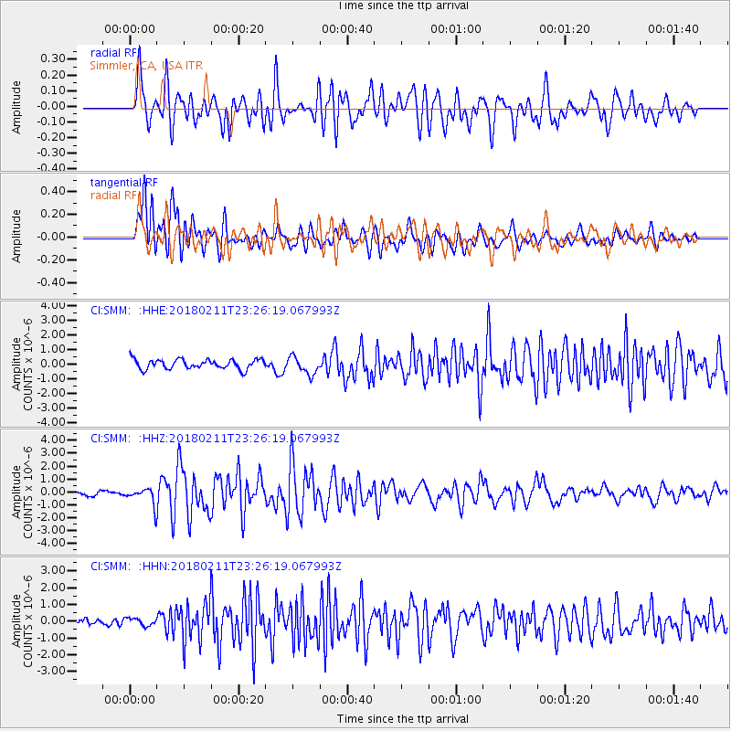
SMM Simmler, CA, USA - Earthquake Result Viewer
*The percent match for this event was below the threshold and hence no stack was calculated.
| Earthquake location: |
South Of Mariana Islands |
| Earthquake latitude/longitude: |
13.8/146.5 |
| Earthquake time(UTC): |
2018/02/11 (042) 23:14:18 GMT |
| Earthquake Depth: |
42 km |
| Earthquake Magnitude: |
6.2 Mi |
| Earthquake Catalog/Contributor: |
NEIC PDE/pt |
|
| Network: |
CI Caltech Regional Seismic Network |
| Station: |
SMM Simmler, CA, USA |
| Lat/Lon: |
35.31 N/120.00 W |
| Elevation: |
599 m |
|
| Distance: |
84.9 deg |
| Az: |
55.037 deg |
| Baz: |
283.249 deg |
| Ray Param: |
$rayparam |
*The percent match for this event was below the threshold and hence was not used in the summary stack. |
|
| Radial Match: |
83.00912 % |
| Radial Bump: |
400 |
| Transverse Match: |
82.405525 % |
| Transverse Bump: |
400 |
| SOD ConfigId: |
13570011 |
| Insert Time: |
2019-04-29 19:28:29.248 +0000 |
| GWidth: |
2.5 |
| Max Bumps: |
400 |
| Tol: |
0.001 |
|
Signal To Noise
| Channel | StoN | STA | LTA |
| CI:SMM: :HHZ:20180211T23:26:19.067993Z | 3.6421614 | 6.640402E-7 | 1.8232038E-7 |
| CI:SMM: :HHN:20180211T23:26:19.067993Z | 0.64341444 | 2.2865069E-7 | 3.553708E-7 |
| CI:SMM: :HHE:20180211T23:26:19.067993Z | 1.774462 | 5.73661E-7 | 3.2328728E-7 |
| Arrivals |
| Ps | |
| PpPs | |
| PsPs/PpSs | |


