
I16A Newdale, ID, USA - Earthquake Result Viewer
| ||||||||||||||||||
| ||||||||||||||||||
| ||||||||||||||||||
|
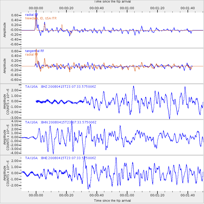
Signal To Noise
| Channel | StoN | STA | LTA |
| TA:I16A: :BHN:20080415T23:07:33.575006Z | 7.57927 | 9.825388E-7 | 1.2963503E-7 |
| TA:I16A: :BHE:20080415T23:07:33.575006Z | 2.1250982 | 4.527447E-7 | 2.1304649E-7 |
| TA:I16A: :BHZ:20080415T23:07:33.575006Z | 2.049664 | 3.3767836E-7 | 1.6474814E-7 |
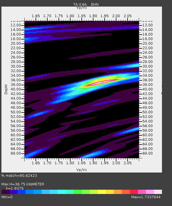
| Arrivals | |
| Ps | 5.9 SECOND |
| PpPs | 16 SECOND |
| PsPs/PpSs | 22 SECOND |

