
I16A Newdale, ID, USA - Earthquake Result Viewer
| ||||||||||||||||||
| ||||||||||||||||||
| ||||||||||||||||||
|
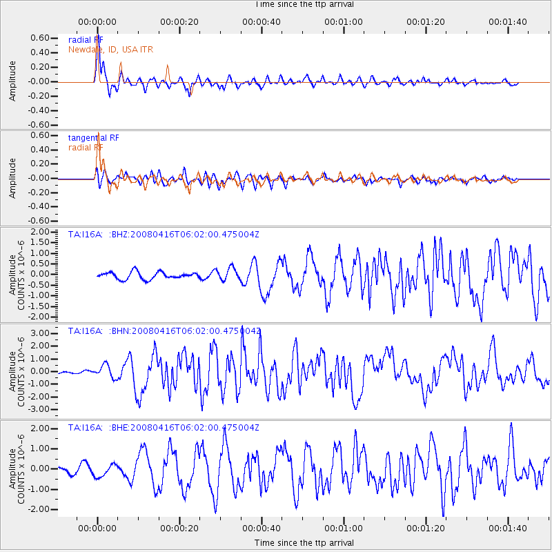
Signal To Noise
| Channel | StoN | STA | LTA |
| TA:I16A: :BHN:20080416T06:02:00.475004Z | 5.341017 | 5.0919743E-7 | 9.533717E-8 |
| TA:I16A: :BHE:20080416T06:02:00.475004Z | 2.908403 | 3.0343202E-7 | 1.0432942E-7 |
| TA:I16A: :BHZ:20080416T06:02:00.475004Z | 1.7747581 | 2.9408443E-7 | 1.6570395E-7 |
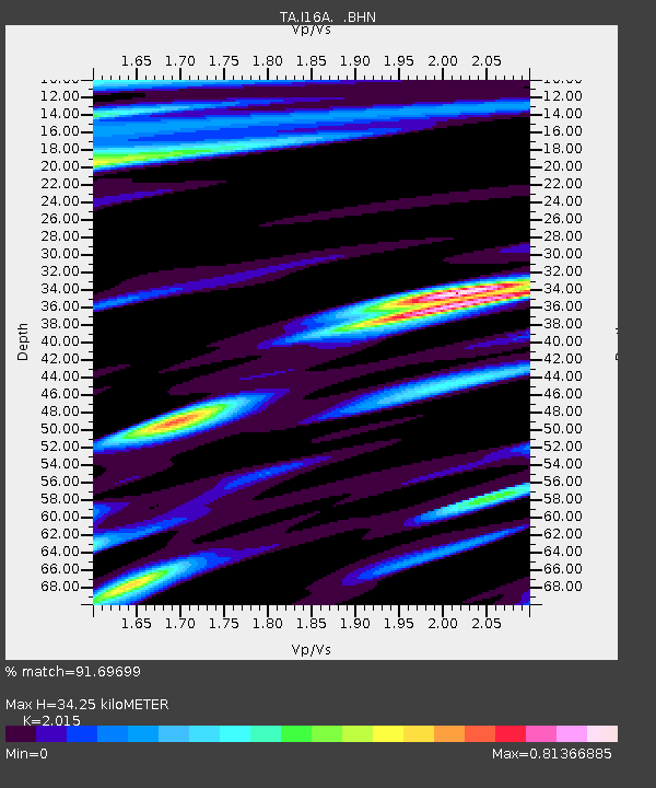
| Arrivals | |
| Ps | 5.9 SECOND |
| PpPs | 16 SECOND |
| PsPs/PpSs | 22 SECOND |

