I16A Newdale, ID, USA - Earthquake Result Viewer
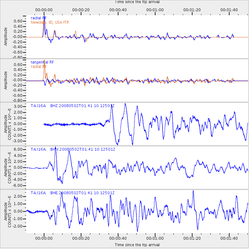
Earthquake location: Andreanof Islands, Aleutian Is.
Earthquake latitude/longitude: 51.9/-177.5
Earthquake time(UTC): 2008/05/02 (123) 01:33:37 GMT
Earthquake Depth: 14 km
Earthquake Magnitude: 6.3 MB, 6.8 MS, 6.6 MW, 6.6 MW
Earthquake Catalog/Contributor: WHDF/NEIC
Network: TA USArray Transportable Network (new EarthScope stations)
Station: I16A Newdale, ID, USA
Lat/Lon: 43.88 N/111.49 W
Elevation: 1744 m
Distance: 43.6 deg
Az: 73.33 deg
Baz: 304.772 deg
Ray Param: 0.07242482
Estimated Moho Depth: 36.0 km
Estimated Crust Vp/Vs: 1.97
Assumed Crust Vp: 6.207 km/s
Estimated Crust Vs: 3.159 km/s
Estimated Crust Poisson's Ratio: 0.33
Radial Match: 91.76721 %
Radial Bump: 358
Transverse Match: 77.93188 %
Transverse Bump: 400
SOD ConfigId: 2504
Insert Time: 2010-03-06 09:02:11.019 +0000
GWidth: 2.5
Max Bumps: 400
Tol: 0.001

Signal To Noise

ChannelStoNSTALTA
TA:I16A: :BHN:20080502T01:41:10.12501Z8.3773348.6345113E-71.0306992E-7
TA:I16A: :BHE:20080502T01:41:10.12501Z3.72707374.2718113E-71.14615695E-7
TA:I16A: :BHZ:20080502T01:41:10.12501Z4.0929763.5173716E-78.593677E-8
Arrivals
Ps5.9 SECOND
PpPs16 SECOND
PsPs/PpSs22 SECOND