You are here: Home > Network List > TA - USArray Transportable Network (new EarthScope stations) Stations List
> Station B18K Kokolik River, AK, USA > Earthquake Result Viewer
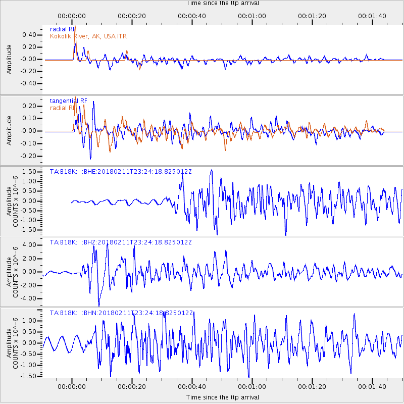
B18K Kokolik River, AK, USA - Earthquake Result Viewer
*The percent match for this event was below the threshold and hence no stack was calculated.
| Earthquake location: |
South Of Mariana Islands |
| Earthquake latitude/longitude: |
13.8/146.5 |
| Earthquake time(UTC): |
2018/02/11 (042) 23:14:18 GMT |
| Earthquake Depth: |
42 km |
| Earthquake Magnitude: |
6.2 Mi |
| Earthquake Catalog/Contributor: |
NEIC PDE/pt |
|
| Network: |
TA USArray Transportable Network (new EarthScope stations) |
| Station: |
B18K Kokolik River, AK, USA |
| Lat/Lon: |
69.36 N/161.80 W |
| Elevation: |
222 m |
|
| Distance: |
64.2 deg |
| Az: |
17.999 deg |
| Baz: |
237.85 deg |
| Ray Param: |
$rayparam |
*The percent match for this event was below the threshold and hence was not used in the summary stack. |
|
| Radial Match: |
87.18668 % |
| Radial Bump: |
400 |
| Transverse Match: |
83.93837 % |
| Transverse Bump: |
400 |
| SOD ConfigId: |
13570011 |
| Insert Time: |
2019-04-29 19:31:21.111 +0000 |
| GWidth: |
2.5 |
| Max Bumps: |
400 |
| Tol: |
0.001 |
|
Signal To Noise
| Channel | StoN | STA | LTA |
| TA:B18K: :BHZ:20180211T23:24:18.825012Z | 1.3885112 | 3.4980928E-7 | 2.519312E-7 |
| TA:B18K: :BHN:20180211T23:24:18.825012Z | 1.5444661 | 2.6340928E-7 | 1.7055038E-7 |
| TA:B18K: :BHE:20180211T23:24:18.825012Z | 1.5488484 | 1.2622614E-7 | 8.1496765E-8 |
| Arrivals |
| Ps | |
| PpPs | |
| PsPs/PpSs | |


