You are here: Home > Network List > TA - USArray Transportable Network (new EarthScope stations) Stations List
> Station C16K Lisburne Hills, AK, USA > Earthquake Result Viewer
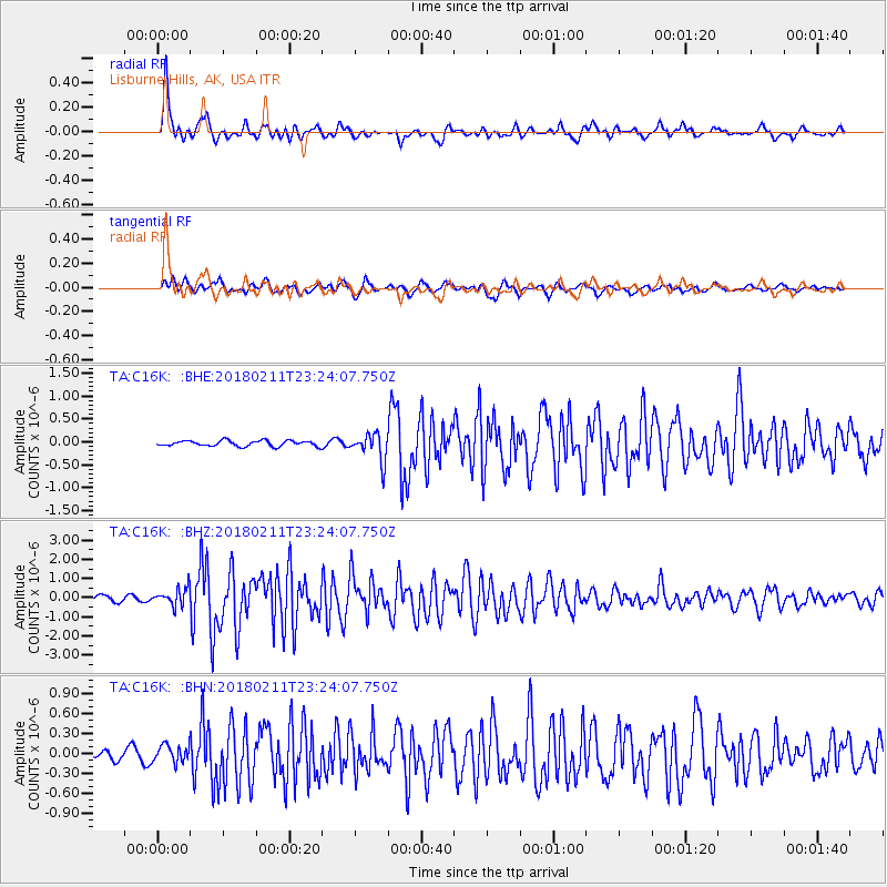
C16K Lisburne Hills, AK, USA - Earthquake Result Viewer
*The percent match for this event was below the threshold and hence no stack was calculated.
| Earthquake location: |
South Of Mariana Islands |
| Earthquake latitude/longitude: |
13.8/146.5 |
| Earthquake time(UTC): |
2018/02/11 (042) 23:14:18 GMT |
| Earthquake Depth: |
42 km |
| Earthquake Magnitude: |
6.2 Mi |
| Earthquake Catalog/Contributor: |
NEIC PDE/pt |
|
| Network: |
TA USArray Transportable Network (new EarthScope stations) |
| Station: |
C16K Lisburne Hills, AK, USA |
| Lat/Lon: |
68.27 N/165.34 W |
| Elevation: |
102 m |
|
| Distance: |
62.5 deg |
| Az: |
18.217 deg |
| Baz: |
234.647 deg |
| Ray Param: |
$rayparam |
*The percent match for this event was below the threshold and hence was not used in the summary stack. |
|
| Radial Match: |
92.81906 % |
| Radial Bump: |
373 |
| Transverse Match: |
78.253296 % |
| Transverse Bump: |
400 |
| SOD ConfigId: |
13570011 |
| Insert Time: |
2019-04-29 19:31:24.158 +0000 |
| GWidth: |
2.5 |
| Max Bumps: |
400 |
| Tol: |
0.001 |
|
Signal To Noise
| Channel | StoN | STA | LTA |
| TA:C16K: :BHZ:20180211T23:24:07.750Z | 2.168403 | 4.4115475E-7 | 2.0344686E-7 |
| TA:C16K: :BHN:20180211T23:24:07.750Z | 1.4764695 | 1.2955971E-7 | 8.774967E-8 |
| TA:C16K: :BHE:20180211T23:24:07.750Z | 2.2625866 | 1.336263E-7 | 5.905909E-8 |
| Arrivals |
| Ps | |
| PpPs | |
| PsPs/PpSs | |


