You are here: Home > Network List > WY - Yellowstone Wyoming Seismic Network Stations List
> Station YHR Hawk's Rest, WY, USA > Earthquake Result Viewer
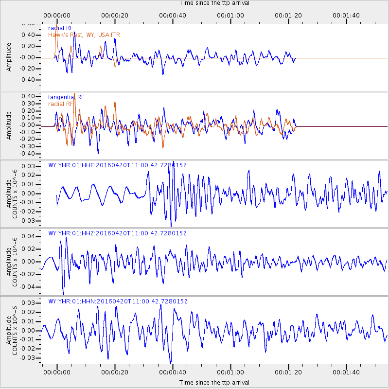
YHR Hawk's Rest, WY, USA - Earthquake Result Viewer
*The percent match for this event was below the threshold and hence no stack was calculated.
| Earthquake location: |
North Atlantic Ocean |
| Earthquake latitude/longitude: |
13.2/-55.9 |
| Earthquake time(UTC): |
2016/04/20 (111) 10:51:39 GMT |
| Earthquake Depth: |
10 km |
| Earthquake Magnitude: |
5.8 MB |
| Earthquake Catalog/Contributor: |
NEIC PDE/NEIC COMCAT |
|
| Network: |
WY Yellowstone Wyoming Seismic Network |
| Station: |
YHR Hawk's Rest, WY, USA |
| Lat/Lon: |
44.11 N/110.08 W |
| Elevation: |
2976 m |
|
| Distance: |
55.4 deg |
| Az: |
314.792 deg |
| Baz: |
106.38 deg |
| Ray Param: |
$rayparam |
*The percent match for this event was below the threshold and hence was not used in the summary stack. |
|
| Radial Match: |
58.467373 % |
| Radial Bump: |
400 |
| Transverse Match: |
47.72239 % |
| Transverse Bump: |
321 |
| SOD ConfigId: |
1475611 |
| Insert Time: |
2016-05-04 11:12:43.443 +0000 |
| GWidth: |
2.5 |
| Max Bumps: |
400 |
| Tol: |
0.001 |
|
Signal To Noise
| Channel | StoN | STA | LTA |
| WY:YHR:01:HHZ:20160420T11:00:42.728015Z | 3.734137 | 2.2996131E-8 | 6.1583525E-9 |
| WY:YHR:01:HHN:20160420T11:00:42.728015Z | 1.5895414 | 1.1042315E-8 | 6.9468555E-9 |
| WY:YHR:01:HHE:20160420T11:00:42.728015Z | 1.9284118 | 1.1828275E-8 | 6.1336873E-9 |
| Arrivals |
| Ps | |
| PpPs | |
| PsPs/PpSs | |


