You are here: Home > Network List > TA - USArray Transportable Network (new EarthScope stations) Stations List
> Station F31M Tsiigehtchic, NWT, CAN > Earthquake Result Viewer
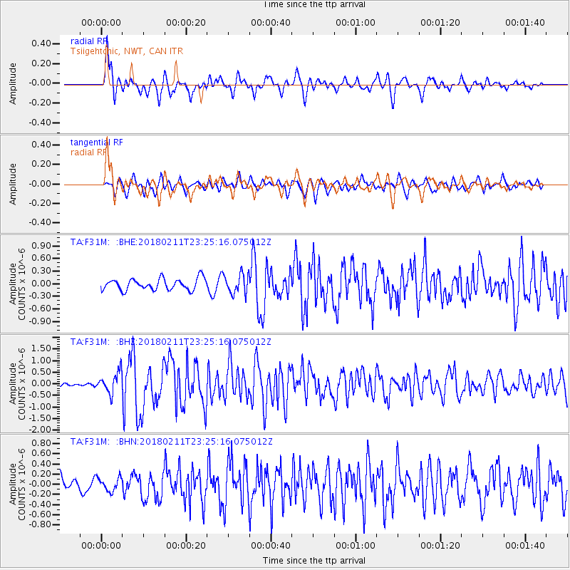
F31M Tsiigehtchic, NWT, CAN - Earthquake Result Viewer
*The percent match for this event was below the threshold and hence no stack was calculated.
| Earthquake location: |
South Of Mariana Islands |
| Earthquake latitude/longitude: |
13.8/146.5 |
| Earthquake time(UTC): |
2018/02/11 (042) 23:14:18 GMT |
| Earthquake Depth: |
42 km |
| Earthquake Magnitude: |
6.2 Mi |
| Earthquake Catalog/Contributor: |
NEIC PDE/pt |
|
| Network: |
TA USArray Transportable Network (new EarthScope stations) |
| Station: |
F31M Tsiigehtchic, NWT, CAN |
| Lat/Lon: |
67.44 N/133.74 W |
| Elevation: |
56 m |
|
| Distance: |
73.4 deg |
| Az: |
23.342 deg |
| Baz: |
265.932 deg |
| Ray Param: |
$rayparam |
*The percent match for this event was below the threshold and hence was not used in the summary stack. |
|
| Radial Match: |
80.63752 % |
| Radial Bump: |
400 |
| Transverse Match: |
74.28447 % |
| Transverse Bump: |
400 |
| SOD ConfigId: |
13570011 |
| Insert Time: |
2019-04-29 19:31:59.668 +0000 |
| GWidth: |
2.5 |
| Max Bumps: |
400 |
| Tol: |
0.001 |
|
Signal To Noise
| Channel | StoN | STA | LTA |
| TA:F31M: :BHZ:20180211T23:25:16.075012Z | 2.9298449 | 4.5218556E-7 | 1.5433771E-7 |
| TA:F31M: :BHN:20180211T23:25:16.075012Z | 0.77868634 | 1.3058904E-7 | 1.677043E-7 |
| TA:F31M: :BHE:20180211T23:25:16.075012Z | 1.8037151 | 2.2957883E-7 | 1.272811E-7 |
| Arrivals |
| Ps | |
| PpPs | |
| PsPs/PpSs | |


