You are here: Home > Network List > TA - USArray Transportable Network (new EarthScope stations) Stations List
> Station I16A Newdale, ID, USA > Earthquake Result Viewer
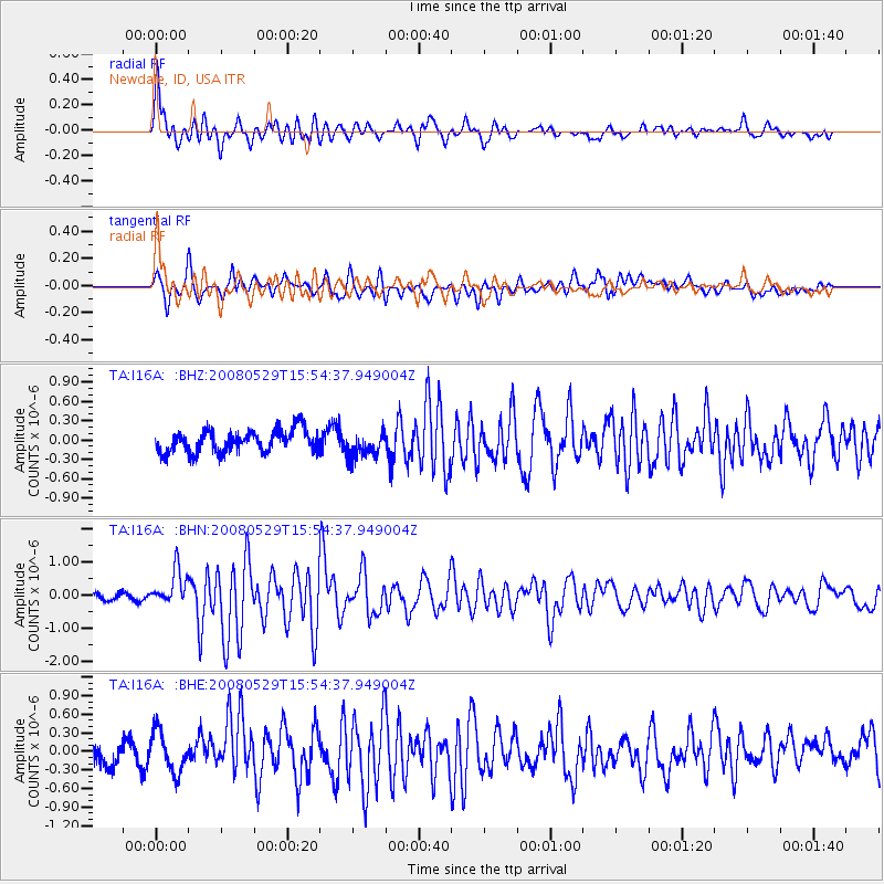
I16A Newdale, ID, USA - Earthquake Result Viewer
*The percent match for this event was below the threshold and hence no stack was calculated.
| Earthquake location: |
Iceland |
| Earthquake latitude/longitude: |
64.0/-21.0 |
| Earthquake time(UTC): |
2008/05/29 (150) 15:46:00 GMT |
| Earthquake Depth: |
10 km |
| Earthquake Magnitude: |
6.0 MB, 6.2 MS, 6.3 MW, 6.2 MW |
| Earthquake Catalog/Contributor: |
WHDF/NEIC |
|
| Network: |
TA USArray Transportable Network (new EarthScope stations) |
| Station: |
I16A Newdale, ID, USA |
| Lat/Lon: |
43.88 N/111.49 W |
| Elevation: |
1744 m |
|
| Distance: |
51.9 deg |
| Az: |
293.187 deg |
| Baz: |
34.067 deg |
| Ray Param: |
$rayparam |
*The percent match for this event was below the threshold and hence was not used in the summary stack. |
|
| Radial Match: |
76.78083 % |
| Radial Bump: |
400 |
| Transverse Match: |
74.41883 % |
| Transverse Bump: |
400 |
| SOD ConfigId: |
2504 |
| Insert Time: |
2010-03-06 09:02:50.560 +0000 |
| GWidth: |
2.5 |
| Max Bumps: |
400 |
| Tol: |
0.001 |
|
Signal To Noise
| Channel | StoN | STA | LTA |
| TA:I16A: :BHN:20080529T15:54:37.949004Z | 4.3773503 | 5.2770895E-7 | 1.2055443E-7 |
| TA:I16A: :BHE:20080529T15:54:37.949004Z | 1.6102078 | 3.3308973E-7 | 2.0686134E-7 |
| TA:I16A: :BHZ:20080529T15:54:37.949004Z | 1.1648841 | 2.0127547E-7 | 1.7278582E-7 |
| Arrivals |
| Ps | |
| PpPs | |
| PsPs/PpSs | |


