You are here: Home > Network List > TA - USArray Transportable Network (new EarthScope stations) Stations List
> Station H31M Peel River, Yukon, CAN > Earthquake Result Viewer
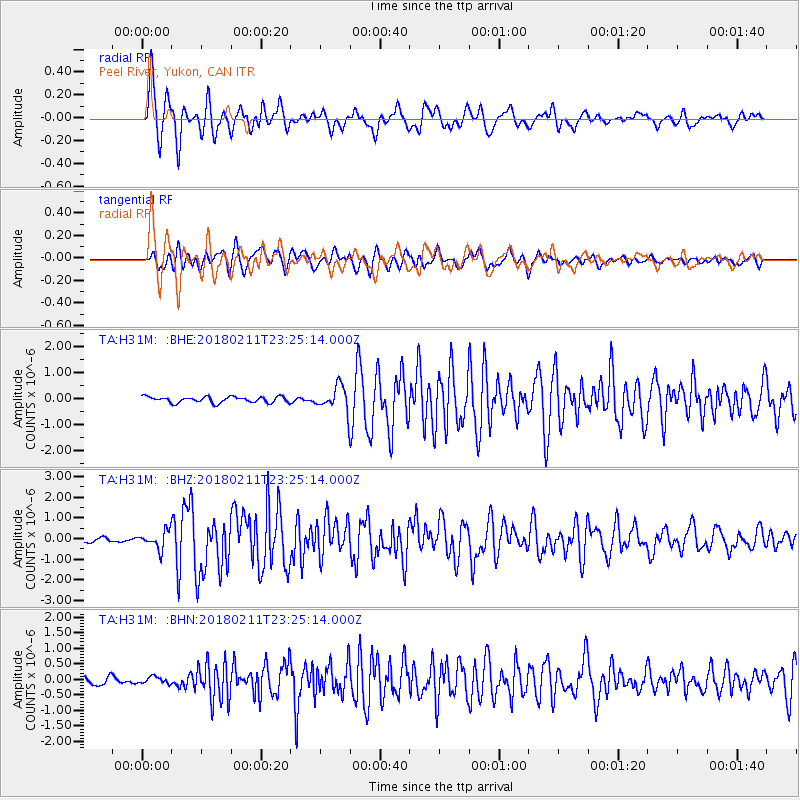
H31M Peel River, Yukon, CAN - Earthquake Result Viewer
*The percent match for this event was below the threshold and hence no stack was calculated.
| Earthquake location: |
South Of Mariana Islands |
| Earthquake latitude/longitude: |
13.8/146.5 |
| Earthquake time(UTC): |
2018/02/11 (042) 23:14:18 GMT |
| Earthquake Depth: |
42 km |
| Earthquake Magnitude: |
6.2 Mi |
| Earthquake Catalog/Contributor: |
NEIC PDE/pt |
|
| Network: |
TA USArray Transportable Network (new EarthScope stations) |
| Station: |
H31M Peel River, Yukon, CAN |
| Lat/Lon: |
65.81 N/134.34 W |
| Elevation: |
642 m |
|
| Distance: |
73.0 deg |
| Az: |
25.036 deg |
| Baz: |
265.871 deg |
| Ray Param: |
$rayparam |
*The percent match for this event was below the threshold and hence was not used in the summary stack. |
|
| Radial Match: |
82.56576 % |
| Radial Bump: |
400 |
| Transverse Match: |
73.54462 % |
| Transverse Bump: |
400 |
| SOD ConfigId: |
13570011 |
| Insert Time: |
2019-04-29 19:32:17.327 +0000 |
| GWidth: |
2.5 |
| Max Bumps: |
400 |
| Tol: |
0.001 |
|
Signal To Noise
| Channel | StoN | STA | LTA |
| TA:H31M: :BHZ:20180211T23:25:14.000Z | 2.316473 | 4.2015913E-7 | 1.8137881E-7 |
| TA:H31M: :BHN:20180211T23:25:14.000Z | 0.51590246 | 1.0895748E-7 | 2.1119784E-7 |
| TA:H31M: :BHE:20180211T23:25:14.000Z | 2.910356 | 3.3105235E-7 | 1.1374977E-7 |
| Arrivals |
| Ps | |
| PpPs | |
| PsPs/PpSs | |


