You are here: Home > Network List > TA - USArray Transportable Network (new EarthScope stations) Stations List
> Station L15K Ungalak Mountain, AK, USA > Earthquake Result Viewer
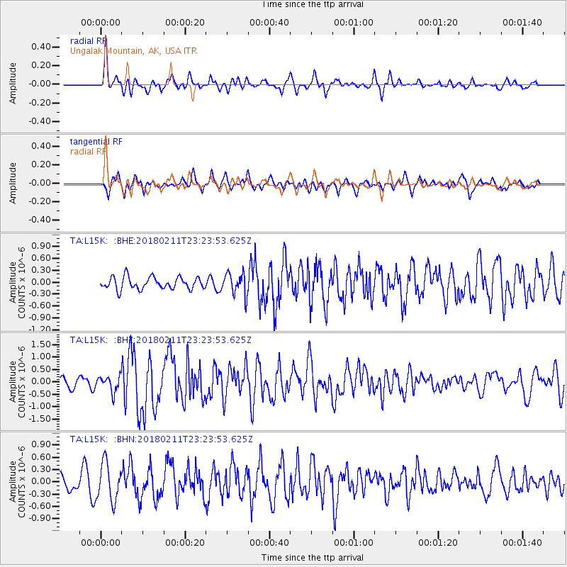
L15K Ungalak Mountain, AK, USA - Earthquake Result Viewer
*The percent match for this event was below the threshold and hence no stack was calculated.
| Earthquake location: |
South Of Mariana Islands |
| Earthquake latitude/longitude: |
13.8/146.5 |
| Earthquake time(UTC): |
2018/02/11 (042) 23:14:18 GMT |
| Earthquake Depth: |
42 km |
| Earthquake Magnitude: |
6.2 Mi |
| Earthquake Catalog/Contributor: |
NEIC PDE/pt |
|
| Network: |
TA USArray Transportable Network (new EarthScope stations) |
| Station: |
L15K Ungalak Mountain, AK, USA |
| Lat/Lon: |
61.68 N/161.49 W |
| Elevation: |
219 m |
|
| Distance: |
60.4 deg |
| Az: |
25.608 deg |
| Baz: |
241.682 deg |
| Ray Param: |
$rayparam |
*The percent match for this event was below the threshold and hence was not used in the summary stack. |
|
| Radial Match: |
75.979324 % |
| Radial Bump: |
400 |
| Transverse Match: |
65.820274 % |
| Transverse Bump: |
400 |
| SOD ConfigId: |
13570011 |
| Insert Time: |
2019-04-29 19:32:37.310 +0000 |
| GWidth: |
2.5 |
| Max Bumps: |
400 |
| Tol: |
0.001 |
|
Signal To Noise
| Channel | StoN | STA | LTA |
| TA:L15K: :BHZ:20180211T23:23:53.625Z | 1.563954 | 3.1787079E-7 | 2.0324818E-7 |
| TA:L15K: :BHN:20180211T23:23:53.625Z | 1.7607288 | 4.6355666E-7 | 2.6327544E-7 |
| TA:L15K: :BHE:20180211T23:23:53.625Z | 1.3352633 | 2.0571386E-7 | 1.5406239E-7 |
| Arrivals |
| Ps | |
| PpPs | |
| PsPs/PpSs | |


