You are here: Home > Network List > TA - USArray Transportable Network (new EarthScope stations) Stations List
> Station I16A Newdale, ID, USA > Earthquake Result Viewer
I16A Newdale, ID, USA - Earthquake Result Viewer
*The percent match for this event was below the threshold and hence no stack was calculated.
| Earthquake location: |
Solomon Islands |
| Earthquake latitude/longitude: |
-10.3/161.2 |
| Earthquake time(UTC): |
2009/01/15 (015) 16:15:01 GMT |
| Earthquake Depth: |
114 km |
| Earthquake Magnitude: |
5.6 MB, 5.7 MW, 5.7 MW |
| Earthquake Catalog/Contributor: |
WHDF/NEIC |
|
| Network: |
TA USArray Transportable Network (new EarthScope stations) |
| Station: |
I16A Newdale, ID, USA |
| Lat/Lon: |
43.88 N/111.49 W |
| Elevation: |
1744 m |
|
| Distance: |
95.1 deg |
| Az: |
46.492 deg |
| Baz: |
260.705 deg |
| Ray Param: |
$rayparam |
*The percent match for this event was below the threshold and hence was not used in the summary stack. |
|
| Radial Match: |
75.46322 % |
| Radial Bump: |
400 |
| Transverse Match: |
48.938057 % |
| Transverse Bump: |
357 |
| SOD ConfigId: |
2834 |
| Insert Time: |
2010-03-06 09:03:17.077 +0000 |
| GWidth: |
2.5 |
| Max Bumps: |
400 |
| Tol: |
0.001 |
|
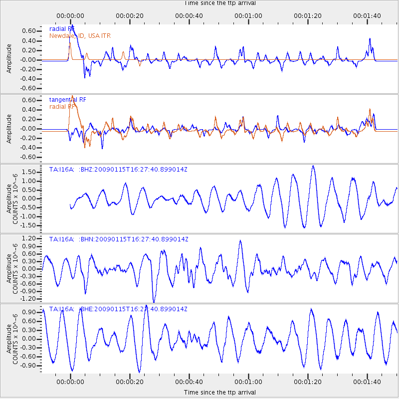
Signal To Noise
| Channel | StoN | STA | LTA |
| TA:I16A: :BHN:20090115T16:27:40.899014Z | 0.8828419 | 3.228966E-7 | 3.657468E-7 |
| TA:I16A: :BHE:20090115T16:27:40.899014Z | 1.7113383 | 7.2743023E-7 | 4.2506514E-7 |
| TA:I16A: :BHZ:20090115T16:27:40.899014Z | 0.22854938 | 9.190543E-8 | 4.0212504E-7 |
| Arrivals |
| Ps | |
| PpPs | |
| PsPs/PpSs | |


